Author: bicotrav

  • Kakamega Forest: Kenya’s Only Rainforest, Birds and Rare Primates

    Kakamega Forest: Kenya’s Only Rainforest, Birds and Rare Primates

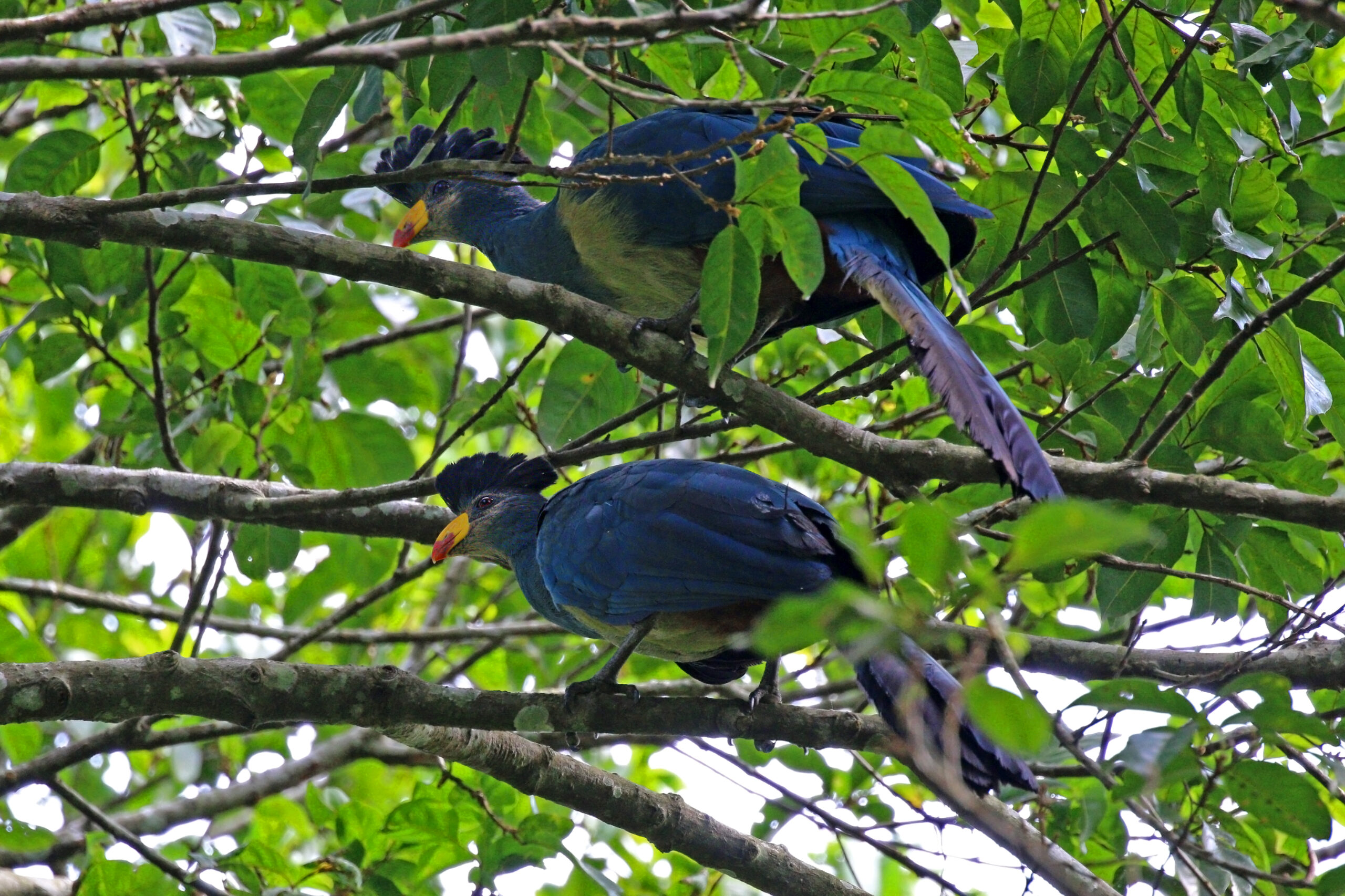
    A Great Blue Turaco, one of Kakamega Forest's signature birds and Kenya's only tropical rainforest resident of its kind
    Photo: Charles J. Sharp, CC BY-SA 4.0, via Wikimedia Commons

    Kakamega Forest is the one place in Kenya where a safari looks nothing like a savanna. It’s the country’s only tropical rainforest – the easternmost surviving fragment of the Guineo-Congolian forest that once stretched across central Africa – and it sits, improbably, in the middle of Western Kenya’s densely farmed sugar and tea country, about 55km north of Kisumu. Almost nobody puts it on a first Kenya trip, which is exactly why the handful of travellers who do make it here tend to come away talking about it more than the Mara.

    Why it’s genuinely different

    Kakamega’s plants, birds and primates have more in common with the forests of Uganda and the Congo than with anything else in Kenya, because this patch is a genetic island – cut off from its parent rainforest for so long that many of its species exist nowhere else in the country. Over 330 bird species have been recorded here, some 16 of them found nowhere else in Kenya, alongside seven primate species and more than 400 types of butterfly. It’s a UNESCO-recognised Important Bird Area, and for birders specifically, it’s often described as one of the best sites in East Africa.

    Things to do

    Birding. The headline draw. Target species include the Great Blue Turaco (a genuinely startling bird – electric blue with a bright yellow-and-red bill, look for it crashing clumsily between canopy branches), Turner’s eremomela and Chapin’s flycatcher (both globally threatened), the blue-headed bee-eater, and the African grey parrot. A knowledgeable local guide, who’ll know which tree a nesting crowned eagle is using that week, makes an enormous difference to what you actually see.

    Primate watching. Black-and-white colobus, red-tailed monkeys, blue monkeys and olive baboons are all reliably spotted along the trails. The forest’s star is the de Brazza’s monkey – a striking, white-bearded, orange-browed species confined in Kenya to the Kisere sector of the national reserve – alongside nocturnal primates like the potto and Demidoff’s galago, best found on a guided night walk.

    Walking trails. Marked trails range from short 1km loops to the half-day Isiukhu Trail, which runs from Isecheno to the small Isiukhu Falls. The 4km walk or drive up to Buyangu Hill is shorter and rewards you with uninterrupted views east across the forest canopy to the Nandi Escarpment. Expect thick red mud after rain – proper footwear matters here more than on any savanna game drive.

    Old mine shafts and giant fig trees. Scattered through the forest are the remains of old mining activity, now used by roosting bats, and a scatter of genuinely enormous fig trees, some reputedly centuries old.
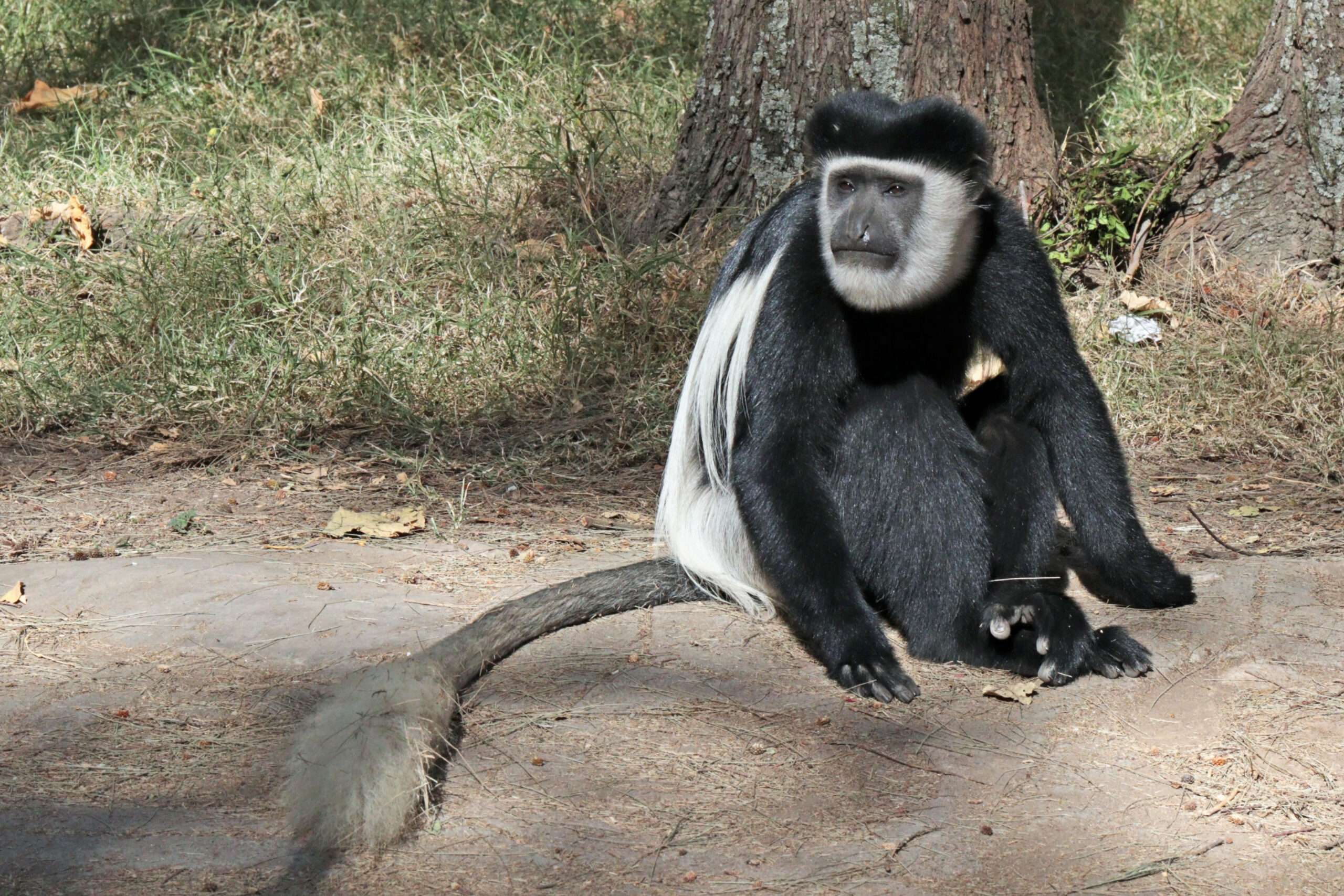
    A black-and-white colobus monkey, the species found in Kakamega Forest
    Photo: Charles J. Sharp, CC BY-SA 4.0, via Wikimedia Commons

    Two forest sectors, two experiences

    Kakamega is split between the Kakamega Forest Reserve (run by the Kenya Forest Service, with Rondo Retreat as its best-known lodge, built on the site of a former timber mill) and the Kakamega Forest National Reserve to the north (run by Kenya Wildlife Service, home to the Buyangu sector and the rare de Brazza’s monkey territory in Kisere). Both are worth knowing about when you’re booking, since guides, entry fees and facilities differ between the two.

    The Luhya communities around the forest

    The forest sits in the heart of Luhya country – Kenya’s second-largest ethnic group, made up of around 18 distinct Bantu subgroups. The Isukha and Idakho, two of those subgroups, are the communities most directly associated with Kakamega itself, historically dependent on the forest for building materials, medicinal plants and bushmeat before conservation restrictions tightened. Circumcision remains an important, still-practised rite of passage among most Luhya subgroups (though not universally – some neighbouring groups, particularly those closer to Luo communities, don’t circumcise), traditionally marking the transition from boyhood to adulthood with an elaborate, community-wide ceremony. If you’re travelling with a local guide, it’s worth asking about which subgroup’s land you’re passing through – Luhya identity is genuinely plural rather than a single homogeneous culture.

    Getting there

    Kakamega town is about 55km (roughly an hour) north of Kisumu and around 350km from Nairobi by road. Most visitors combine it with a wider Kisumu-based western Kenya loop rather than visiting as a standalone destination, since there’s no direct scheduled air service to the forest itself.

    Best time to visit

    Rain falls year-round in this part of Kenya, and Kakamega is wetter than almost anywhere else in the country – come prepared for mud regardless of season. The driest stretches are typically December to February and June to August, which also tend to be the easiest months for birding since trails are less waterlogged.

    FAQ

    Do I need a guide? Technically no, but practically yes – the forest is dense, trails fork often, and a guide is the difference between hearing birds and actually seeing the species you came for.

    Is Kakamega worth it if I’m not a serious birder? Yes, if you enjoy walking, primates or simply want to see rainforest rather than savanna – but birders will get the most out of it by a wide margin.

    Can I combine Kakamega with Kisumu in one trip? Easily – it’s a comfortable day trip or overnight from Kisumu, and pairs naturally with the rest of a western Kenya itinerary.

    Related

  • Migori Travel Guide: Thimlich Ohinga, Migingo Island and Kenya’s Southwest

    Migori Travel Guide: Thimlich Ohinga, Migingo Island and Kenya’s Southwest

    Thimlich Ohinga, a 500-year-old dry-stone walled settlement in Migori County, Kenya, and a UNESCO World Heritage Site
    Photo: Wycondi, CC BY-SA 3.0, via Wikimedia Commons

    Migori sits in Kenya’s far southwest, wedged between Lake Victoria and the Tanzanian border, and it rarely makes it onto a first-time Kenya itinerary. That’s mostly geography – it’s a long way from anywhere else on the tourist circuit – but it’s also the county with the region’s most genuinely startling sight: a five-century-old stone fortress that most visitors to Kenya have never heard of.

    Thimlich Ohinga

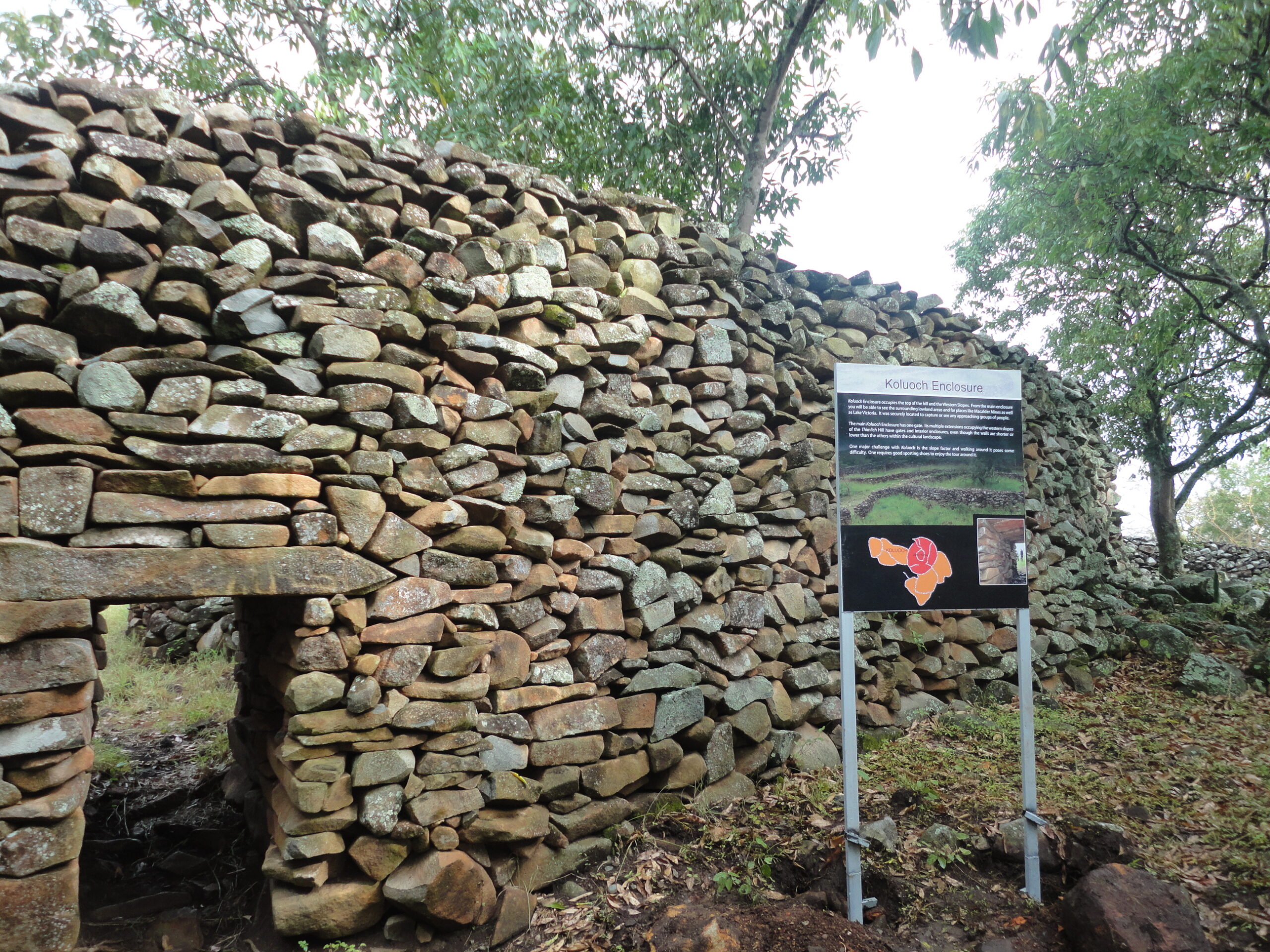
    Thimlich Ohinga is the reason to make the detour. It’s a UNESCO World Heritage Site (inscribed 2018) and the largest and best-preserved of over 500 dry-stone enclosures scattered across the Lake Victoria Basin – built without any mortar, its walls run 1 to 4.2 metres high and up to 3 metres thick, made from undressed local basalt stones fitted together with a precision that still isn’t fully understood. The name is Dholuo: thimlich means a frightening, dense forest, and ohinga means a large fortress – a fitting description for a structure hidden in the bush 46km northwest of Migori town. Construction is generally dated to the 15th or 16th century, likely started by Bantu-speaking communities before Luo groups settled and expanded it over the following centuries; the four main enclosures (Kochieng, Kakuku, Koketch and Koluoch) probably worked as fortified homesteads, protecting people and livestock from raiders while also marking out lineage and status. It’s often compared, on a smaller scale, to Great Zimbabwe over 3,000km to the south – a similar dry-stone tradition arrived at independently. Getting there takes real effort (a rough road from Migori town, best with a 4×4 or a local guide), and the site itself is quiet even by Kenya’s already-uncrowded heritage-site standards, which is part of what makes it worth the trip.

    Migingo Island

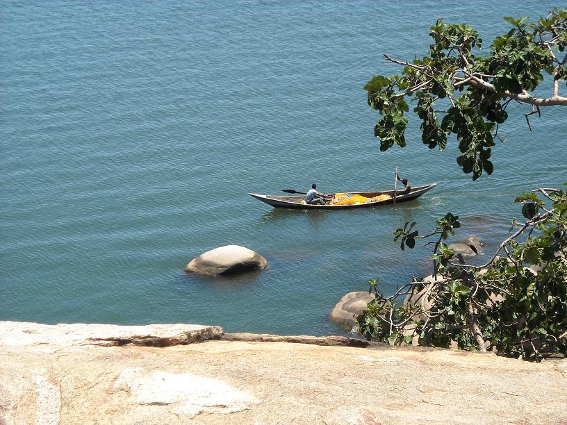
    Just offshore in Lake Victoria sits one of the odder footnotes in East African geography: Migingo Island, a rock barely half the size of a football pitch, claimed by both Kenya and Uganda and, at times, home to several hundred fishermen packed into corrugated-iron shacks built almost on top of each other. The draw is Nile perch – the deep water around Migingo is some of the richest fishing ground left in the lake – and the dispute has rumbled on for two decades, largely resolved in Kenya’s favour by a 2009 joint survey that placed the island about 510 metres inside Kenyan waters, though friction over fishing rights in the surrounding lake continues. It isn’t a tourist site as such (there’s no formal way to visit, and conditions on the island are rough), but a boat trip out from Muhuru Bay or Karungu that passes within sight of it is a good way to understand just how much this stretch of the lake still runs on fish.

    Things to do

    Muhuru Bay on Lake Victoria, Migori County, Kenya
    Photo: Ckodero, CC BY-SA 4.0, via Wikimedia Commons

    Muhuru Bay. A lakeside town near the Tanzanian border with some of the best sunset views on the Kenyan side of Lake Victoria, plus a working pier and fish landing scene similar in spirit to Homa Bay’s, just far smaller and quieter.

    Gogo Falls. A waterfall on the Kuja River near Awendo, with a hydroelectric plant (commissioned in 1957, originally to power the Macalder mines) and an associated prehistoric site nearby that points to very early human presence in the area.

    Macalder Mines. The site of Kenya’s most significant historical gold rush, discovered in 1904 with serious mining activity through the 1920s and 30s – now a quiet, half-abandoned mining landscape rather than an operating attraction, but a striking one for anyone interested in Kenya’s colonial-era industrial history. Small-scale artisanal gold mining still continues informally in parts of the county.

    Kuria culture. Southern Migori, toward the Tanzanian border around Kehancha and Isibania, is Kuria territory – a Bantu community distinct from the Luo majority elsewhere in the county, with their own age-set governance traditions and a history of cross-border ties into northern Tanzania.

    Getting there

    Migori town is about 400km (6-7 hours) from Nairobi by road, most commonly via Kisii, and roughly 90km (1.5-2 hours) south of Kisumu. It also sits just 22km from the Tanzanian border at Isebania/Sirare, making it a realistic overland crossing point if you’re continuing on to the Serengeti or Mwanza. There’s no scheduled passenger airport in the county, so this is self-drive or bus-and-matatu territory.

    Best time to visit

    Like the rest of the Lake Victoria basin, Migori sees rain most of the year, heaviest from March to May with a shorter spell around October-November. December to February is generally the most reliable window, and it’s also the easiest time to manage the rough road out to Thimlich Ohinga.

    FAQ

    Can I actually visit Thimlich Ohinga? Yes – it’s open to the public and managed by the National Museums of Kenya, though facilities are basic. A local guide or driver familiar with the access road makes the visit far easier.

    Is Migingo Island open to visitors? Not in any formal tourist sense – it’s a working fishing settlement, not a destination, and there’s no infrastructure for visitors to land or stay.

    Is Migori worth a special trip, or only if I’m crossing into Tanzania? Thimlich Ohinga alone is worth a dedicated day if you’re already in the Kisumu-Kisii-Homa Bay area; for most other travellers, Migori makes most sense combined with a Tanzania border crossing or a longer western Kenya loop.

    Related

  • Homa Bay Travel Guide: Big Fish, Kendu Bay and Lake Victoria’s Southern Shore

    Homa Bay Travel Guide: Big Fish, Kendu Bay and Lake Victoria’s Southern Shore

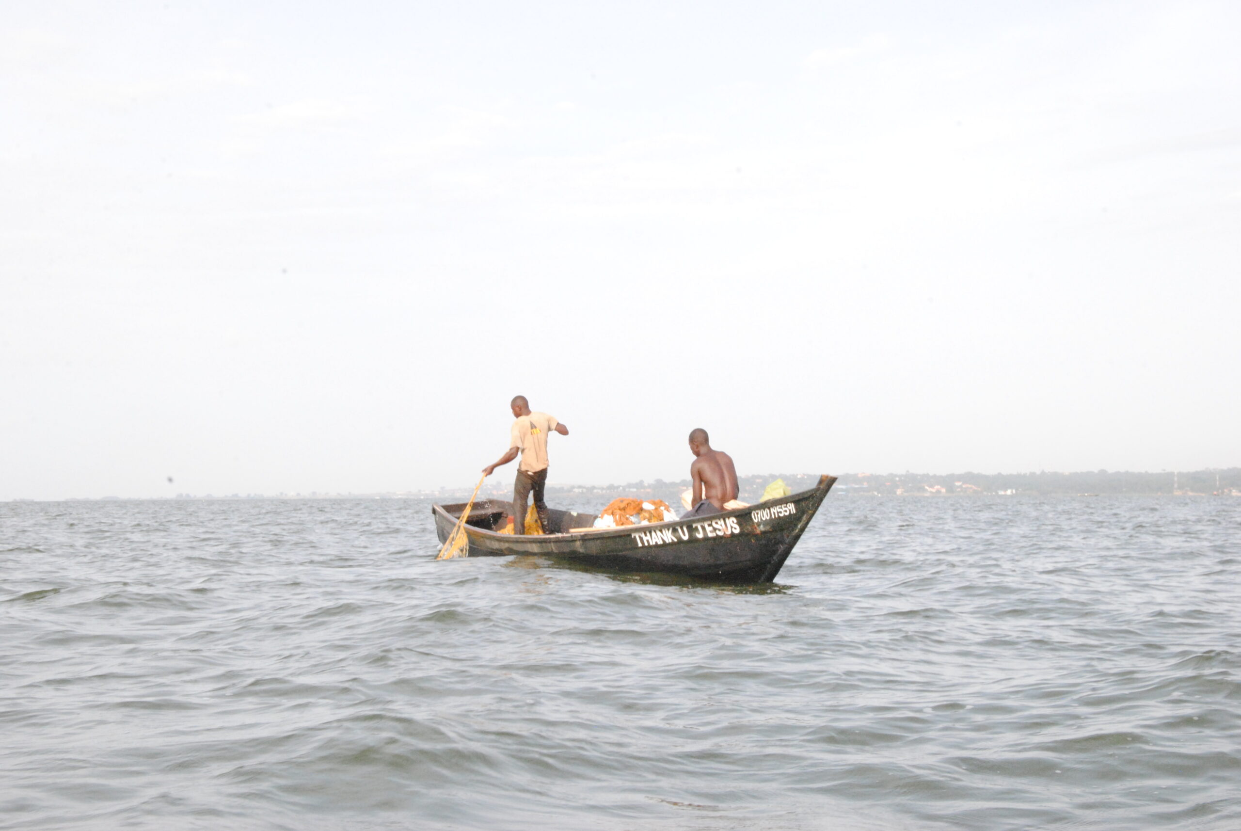
    Fishermen working the waters of Lake Victoria, the lake that sustains Homa Bay's fishing economy
    Photo: Jöseph Ashaba, CC BY-SA 4.0, via Wikimedia Commons

    Homa Bay sits on the southern shore of the Winam Gulf, the arm of Lake Victoria that reaches deepest into Kenya, and everything about the town runs on lake time. Boats go out before dawn, land their catch by mid-morning, and by noon the fish has already changed hands two or three times on its way from net to plate. It’s one of Kenya’s most productive fishing grounds and one of its least-visited county capitals — which is exactly what makes it worth the detour off the Kisumu-Kisii road.

    Where the big fish come in

    The single best reason to stop in Homa Bay is to watch the catch come ashore. Nile perch, introduced into Lake Victoria in the 1950s, is the fish that built the modern economy of this shoreline — it can grow to well over 100kg and two metres long, and even an average market-day fish arrives on a bicycle or a porter’s shoulders looking genuinely enormous next to everything around it. Fishermen bring their catch in at landing sites like Koginga Beach, on the edge of town, where it’s sorted, weighed and sold on within hours. Homa Bay’s fish market, rebuilt and reopened in 2025 as one of the largest and most modern facilities on the lake, now handles thousands of traders a day, with cold storage and proper washing areas replacing what used to be an open beachside scramble.

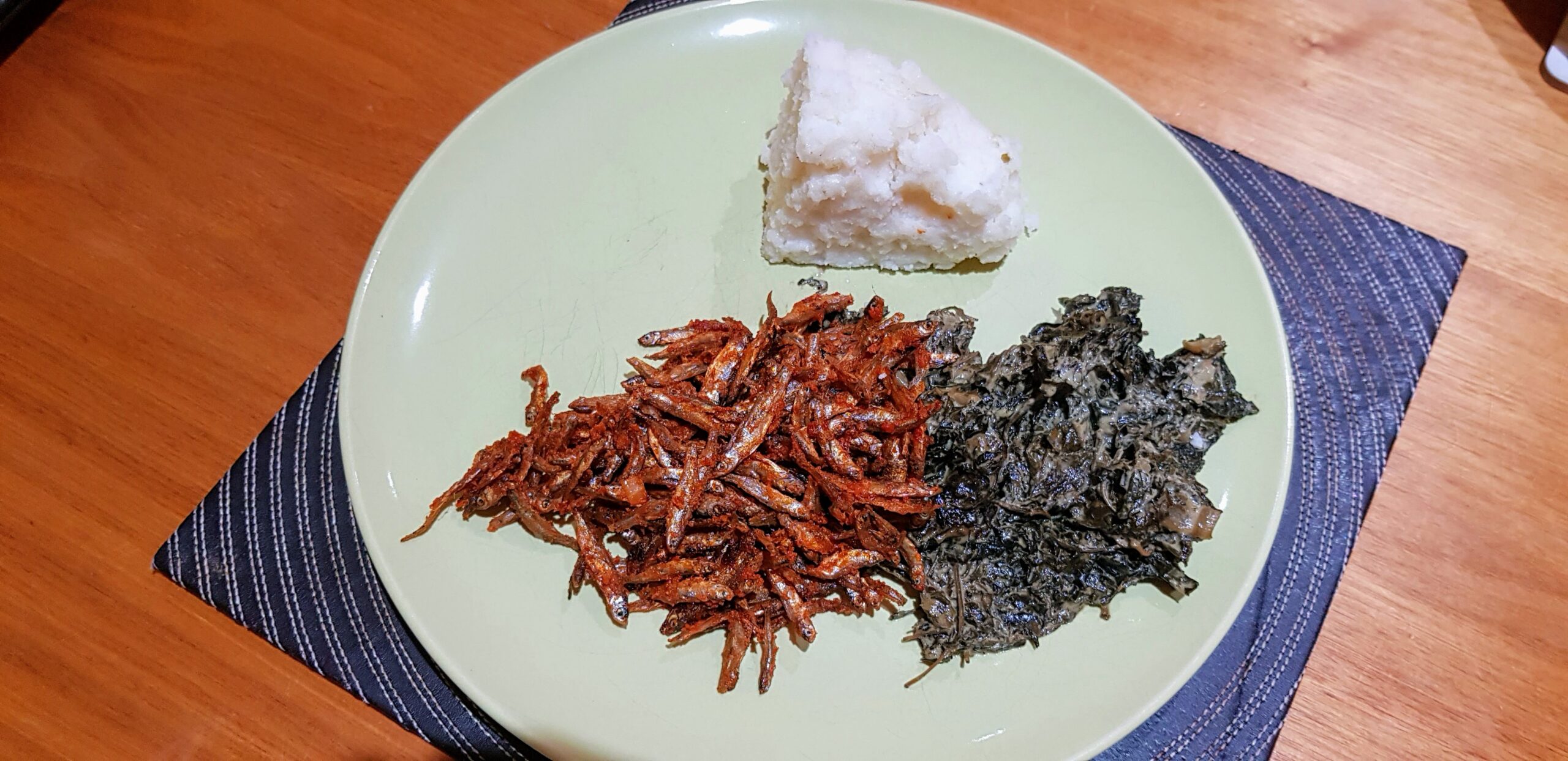
    Watching a big Nile perch land is a proper spectacle: it usually takes two people to carry one, scales flashing silver-grey in the sun, and a crowd of buyers, fishmongers and onlookers gathers before the boat has even beached. Alongside the perch, women sort mountains of omena (silver cyprinid, a small sardine-like fish) into baskets for drying and frying — it’s the everyday protein of the lake region, sun-dried on raised racks along the shore and sold by the tin rather than the kilo. Tilapia and catfish round out the catch, laid out on wooden tables between the two.

    Omena, vegetables and ugali — the everyday meal built around Lake Victoria's small fish
    Photo: Wikimedia Commons contributor, CC BY-SA 4.0

    There’s a less visible trade running alongside the visible one. Nile perch swim bladders, known locally as mondo, are cut out and sold separately to Chinese buyers for use in soup and traditional medicine — a kilo of maw can fetch far more than a kilo of the fish itself, which is part of why Homa Bay’s fisheries officers keep a close watch on undersized catches. None of this is hidden from view exactly, but it’s the kind of detail a market walk with a local will explain far better than a guidebook can.

    Kendu Bay

    About 30km northeast of Homa Bay town, Kendu Bay is a smaller, older lakeside settlement with a genuinely strange landmark just outside it: Lake Simbi Nyaima, a near-perfectly circular crater lake with no known inlet or outlet, ringed by acacia scrub and, in season, thousands of migrating flamingos arriving from the Rift Valley soda lakes. Luo oral tradition holds that a village once stood on the site and was swallowed overnight after its residents turned away an old woman asking for food and shelter — only the family that helped her survived, and the lake rose where the village had been. Geologists offer a more prosaic explanation involving a volcanic crater roughly six centuries old, but both accounts agree on one thing: something happened here that the landscape still remembers.

    Kendu Bay itself was once a significant port, with a pier that received steamers from as far as Uganda and Tanzania during the colonial era, and a lakeside show ground that made it, for a period, the entertainment capital of Nyanza. Both have faded, but the town remains a working fish landing point in its own right, smaller and quieter than Homa Bay’s rebuilt market but with the same rhythm of boats, buyers and baskets each morning.

    The Abasuba, a different people on the lake

    Rusinga and Mfangano aren’t just Luo territory with a fossil site and a mausoleum attached — they’re the heartland of the Abasuba (Suba), a Bantu people distinct from the Nilotic Luo who dominate the rest of Homa Bay County. Suba tradition holds that small clan groups crossed the lake by boat from the Buganda and Busoga side of Uganda, beginning around the 16th to 18th centuries, and settled these islands and pockets of the eastern shore before the Luo arrived in the area in numbers. Centuries of intermarriage and shared fishing life mean most Suba on the mainland now speak Luo as a first language and are often called Luo-Abasuba, but the islands — Mfangano especially — still hold onto Suba language, clan totems and a cultural identity distinct from their Luo neighbours. The annual Rusinga Festival exists specifically to keep that identity visible; if the timing lines up, it’s a far richer way to understand the islands than a fossil-and-mausoleum day trip alone.

    Beyond the market

    Ruma National Park. Kenya’s only park in the former Nyanza Province, about an hour from Homa Bay town in the Lambwe Valley. It’s the last stronghold of the roan antelope in Kenya, alongside Jackson’s hartebeest, buffalo, and reintroduced giraffe — and one of the quietest, least-crowded parks in the country.

    Rusinga Island. Connected to the mainland near Mbita by a causeway, Rusinga holds the mausoleum of Tom Mboya, one of Kenya’s most influential independence-era leaders, and some of the richest early-hominin fossil sites in East Africa.

    Mfangano Island. Further out into the lake, reachable by boat, with ancient rock art sites attributed to the Twa people who lived here before the Luo migration.

    Getting there

    Homa Bay is roughly 110km (2-2.5 hours) from Kisumu and about 350km (6-7 hours) from Nairobi by road, most commonly via Kisumu or via Kericho and the Kisii route. Kisumu International Airport is the nearest airport with scheduled flights; Homa Bay also has a small local airstrip. Kendu Bay sits directly on the Kisumu-Homa Bay road, so it’s an easy stop either on the way in or out.

    Best time to visit

    The lake basin is warm and fairly humid year-round, with the heaviest rain from March to May and a shorter wet spell around October-November. December to February and June to September are generally the most comfortable windows, and also line up well with the flamingo season at Simbi Nyaima.

    FAQ

    Can visitors actually walk through the fish market? Yes — the Homa Bay Town Modern Fish Market is a working public market, busiest in the mid-morning as boats land. Go with a local guide or driver if you want the full context on what you’re seeing.

    Is Simbi Nyaima swimmable? Locals consider the water to have curative properties for skin conditions, but it’s a highly alkaline crater lake with no real facilities — treat it as a viewpoint and a place to look for flamingos rather than a swimming spot.

    How does Homa Bay compare to Kisumu as a base? Kisumu has far more hotel and restaurant choice; Homa Bay is smaller and more working-town, better suited to a day trip or one night than a multi-night base.

    Related

  • Mombasa Old Town: History, Food and a Day Beyond the Beach

    Mombasa Old Town: History, Food and a Day Beyond the Beach

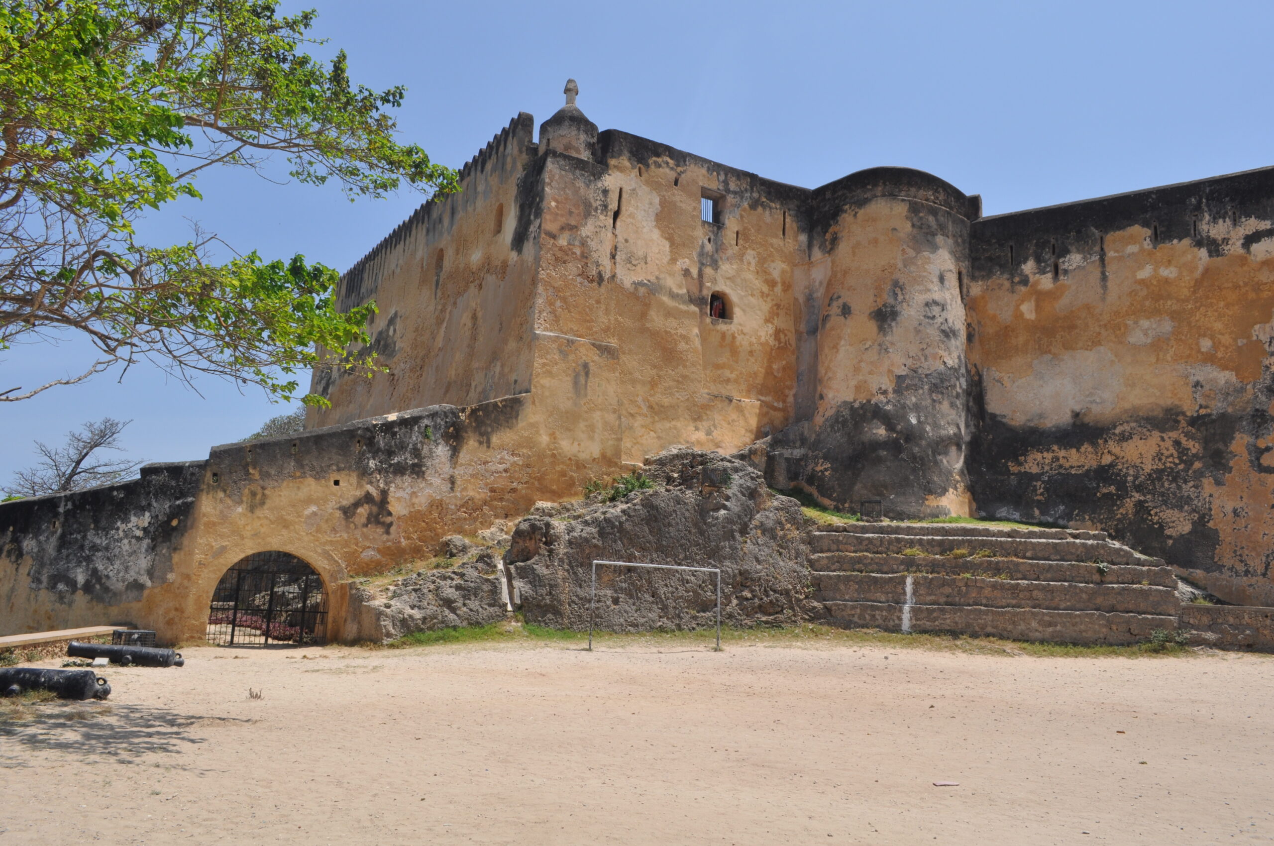
    Fort Jesus, the 16th-century Portuguese fort overlooking Mombasa's Old Port, Kenya
    Photo: Alex Wafula, CC BY-SA 3.0, via Wikimedia Commons

    Most Mombasa trips get compressed into a single line on a Kenya itinerary – “add a few beach days on the coast” – and the beach really is worth it. But Mombasa itself, the island city the beaches are named after, has 500 years of Swahili, Arab, Portuguese and British history packed into a few square kilometres, plus one of Kenya’s best food scenes. This is the deeper dive for the day or two most visitors spend in the city before or after the sand.

    A layered history

    Mombasa has been a trading port for over a thousand years, sitting on the Indian Ocean routes that connected East Africa to Arabia, Persia and India. Swahili city-state culture – a fusion of African, Arab and Persian influence built on that trade – shaped the town long before European contact. The Portuguese arrived in 1498 and eventually built Fort Jesus between 1593 and 1596 to control the harbour; Omani Arab forces besieged and captured it in one of the longest sieges in African colonial history, from 1696 to 1698, and Omani rule followed for much of the next two centuries. The British made Mombasa the capital of colonial Kenya before shifting administration to Nairobi, and the city’s mixed Swahili-Arab-Indian-British architectural and cultural layers are still the main reason to walk its streets today.

    Fort Jesus and Old Town

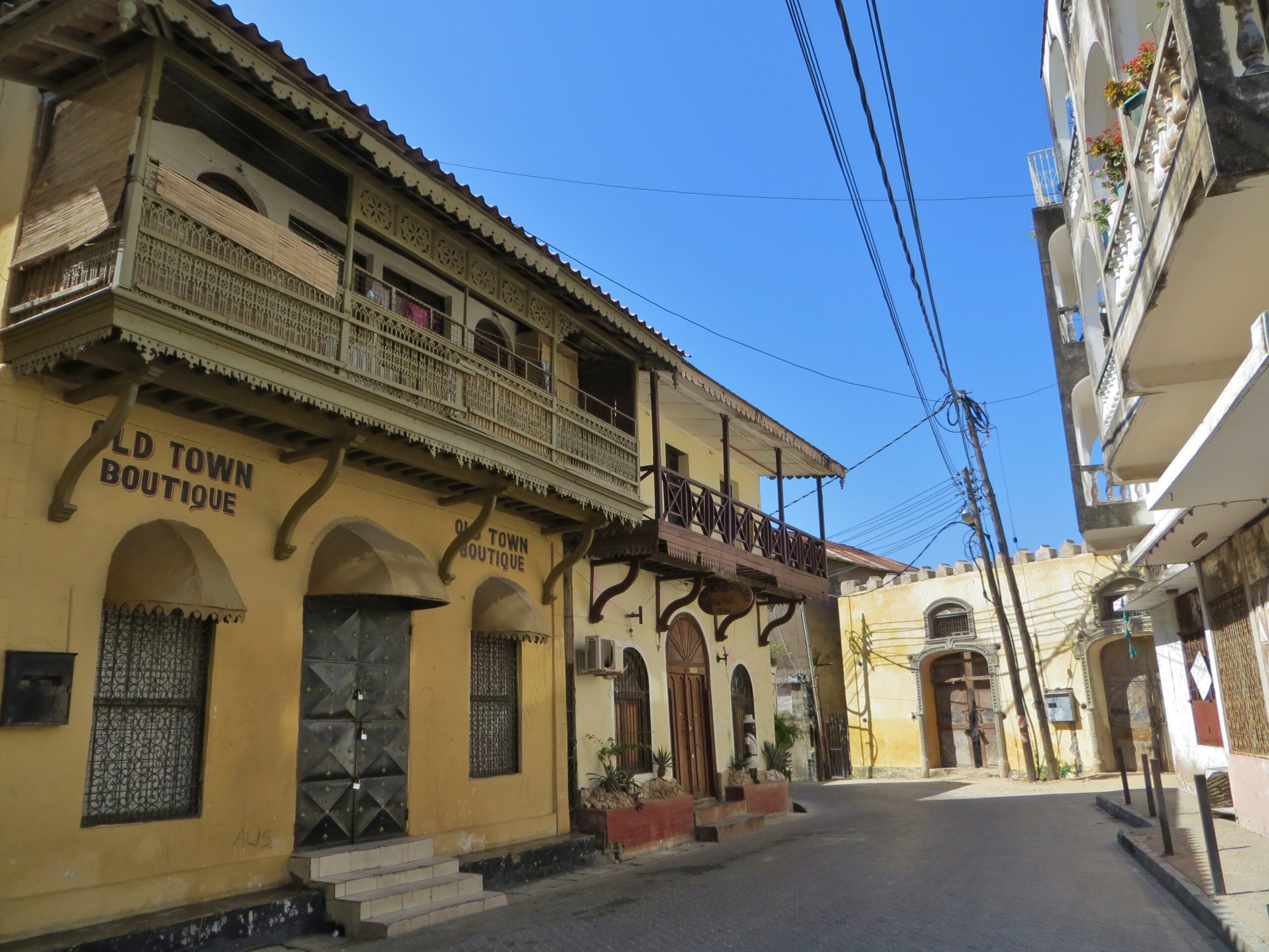
    Fort Jesus, a UNESCO World Heritage Site since 2011, is the obvious anchor – designed by Italian architect Giovanni Battista Cairati in the shape of a man viewed from above, it now houses a museum covering the fort’s Portuguese, Omani and British occupations. Give it an hour or two, then walk into Old Town itself: narrow coral-stone streets, elaborately carved wooden doors (a status marker historically tied to a family’s wealth and standing), balconied Swahili-Arab houses, and a functioning neighbourhood rather than a museum piece – people still live, trade and pray here. It rewards slow wandering more than a checklist, and a local guide is worth it for the history behind the doors and buildings you’d otherwise walk past.

    A view of Mombasa Old Town, Kenya
    Photo: FredD, CC BY-SA 3.0, via Wikimedia Commons

    Mombasa’s neighbourhoods

    Old Town. The historic core on the island’s east side, overlooking the Old Port and Fort Jesus – history, architecture and the city’s best traditional Swahili food, but limited beach-hotel infrastructure.

    Nyali. Just across Nyali Bridge on the mainland north of the island, Nyali is Mombasa’s most convenient upscale base – beach hotels, malls, and the city’s densest restaurant scene, close enough to Old Town for an easy day trip in.

    Bamburi and Shanzu. Further up the North Coast, with a longer run of beach and higher-volume beach-resort restaurants and water sports, popular with both tourists and Mombasa residents on weekends.

    Kizingo and Mombasa Island’s town centre. The commercial CBD and government quarter, useful for practicalities (banks, SGR connections) rather than sightseeing.

    Likoni. The mainland ferry crossing point south of the island – the transit hub for reaching Diani Beach and the South Coast, and a slice of everyday Mombasa life in its own right (Likoni’s ferry crossing carries tens of thousands of pedestrians, cars and boda-bodas every day).

    Mosques and churches worth a look

    Old Town’s religious architecture is as layered as everything else about it. Mandhry Mosque, on Sir Mbarak Hinawy Road, is generally reckoned the oldest mosque still in continuous use in the city, founded by Omani settlers around 1570 and named for the clan that has maintained it ever since – predating Fort Jesus itself, and built, unusually, with two mihrabs (prayer niches marking the direction of Mecca), a feature shared with only one other mosque in the world. It isn’t generally open to non-Muslim visitors inside, but the coral-stone facade and rounded minaret are worth seeking out on a walk through Old Town. A short walk away, Mombasa Memorial Cathedral, the Anglican cathedral for the diocese since 1898, and the Catholic Holy Ghost Cathedral both reflect the city’s British-era Christian presence layered on top of thirteen centuries of Islamic and Swahili history – visible proof that Mombasa’s cosmopolitan reputation isn’t just a marketing line.

    What to eat

    Swahili cuisine is Mombasa’s best argument for a longer stay – centuries of Arab, Indian and African trade compressed into one plate. Look for biryani ya kuku (a distinctly Swahili take on chicken biryani, layered and fragrant rather than the drier Indian style), pilau (spiced rice cooked with meat, cloves, cardamom and black pepper), samaki wa kupaka (grilled fish – often snapper or kingfish – finished in a coconut, lime and turmeric sauce), and mshikaki (marinated grilled meat skewers) as street food. For breakfast, mahamri (cardamom-scented coconut doughnuts) with mbaazi (pigeon peas in coconut milk) and sweet spiced chai is the local standard, and viazi karai (spiced, batter-fried potatoes) makes a good street-food snack any time of day. Old Town has the most historic Swahili-Indian cooking; Nyali has the widest range of sit-down restaurants; Bamburi and Shanzu lean toward beach-resort dining.

    Beyond the city

    Haller Park. A former limestone quarry turned nature reserve near Bamburi, with giraffes, hippos, buffalo and a walk-through reptile park – a relaxed half-day, especially good with kids.

    Mombasa Marine National Park. A protected reef off Nyali and Bamburi reachable by glass-bottomed boat, good for snorkelling among coral gardens close to shore.

    Wasini Island and Kisite-Mpunguti Marine Park. A longer day trip south past Diani, known for dolphin-watching boat trips, snorkelling on one of Kenya’s best coral reefs, and a seafood lunch on the island.

    Shimba Hills National Reserve. Forested hills inland from Diani with the rare sable antelope and Sheldrick Falls – a change of pace from beach and Old Town if you have an extra day.

    Getting around

    Mombasa Island is compact enough to walk in Old Town, but tuk-tuks (locally “tuktuk”) and matatus cover the rest of the city cheaply. The Likoni ferry (free, frequent, and often crowded) is the main link to the South Coast and Diani; a longer-planned floating bridge has been proposed to ease the crossing but the ferry remains the standard route for now. Ride-hailing apps work reliably within the city and North Coast suburbs.

    Getting there

    Domestic flights connect Nairobi to Mombasa in about an hour and run frequently throughout the day – the easiest option for most itineraries. The SGR (Standard Gauge Railway) is a scenic overland alternative, taking roughly five hours between the two cities. From the Maasai Mara or Amboseli, flying via Nairobi rather than attempting a direct overland connection is the standard approach.

    Best time to visit

    December to March and July to October are the driest, most reliable windows on the coast; expect the heaviest rain roughly April to June, with a shorter secondary wet spell around November.

    FAQ

    Is a day enough for Old Town and Fort Jesus? A half-day covers the highlights; a full day gives you time to wander without rushing and add a proper Swahili lunch.

    Should I base myself in Old Town or Nyali? Nyali or the North Coast suburbs suit most travellers better – easy access to Old Town for sightseeing, with far more choice for beach hotels, restaurants and evening options.

    Is the Likoni ferry safe for tourists? Yes, though it gets very crowded at peak commuting hours – keep valuables secure and expect a wait if you’re crossing with a vehicle at busy times.

    Related

  • Kisii Travel Guide: Soapstone, Highlands and Kenya’s Western Circuit

    Kisii Travel Guide: Soapstone, Highlands and Kenya’s Western Circuit

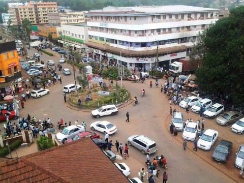
    A roundabout in Kisii town, capital of Kisii County in the Gusii Highlands, Kenya
    Photo: Engdamian, CC BY-SA 3.0, via Wikimedia Commons

    Kisii sits high in Kenya’s western highlands, a hillside trading town that most travellers only glimpse from a matatu window en route between Kisumu and the Maasai Mara. That’s a shame, because Kisii – headquarters of the Gusii (Abagusii) people and Kenya’s soapstone capital – is one of the more distinctive stops on the western circuit, built around a craft tradition that’s been worked out of these hills for over a century.

    Why visit

    Kisii town is the commercial heart of the Gusii Highlands, a densely farmed, tea-and-banana landscape at around 1,700m elevation that stays green and cool year-round – a striking contrast to the heat of the lake basin below or the savanna of the Mara further east. The county’s real draw is Tabaka, a cluster of villages 20-24km west of town that has mined and carved soapstone since at least 1885 and now supports thousands of carvers, making it one of the few places in Kenya where you can watch an entire craft economy at work, from quarry to finished sculpture. Kisii also functions as a practical hinge point on the western Kenya tourist circuit, sitting between Kisumu, Lake Victoria, the Maasai Mara and Ruma National Park.

    Things to do

    Tabaka soapstone workshops. The centre of Kenya’s soapstone industry, where quarrying and carving have been a way of life for generations – men typically mine and rough-carve the stone by hand from open pits, women sand, dye and polish the finished pieces. Several workshops welcome visitors to watch the process from raw block to bowl, sculpture or chess set, and buying directly here supports carvers rather than middlemen. The stone itself ranges from creamy white and pink to grey and black, and pieces are sold both in Tabaka’s roadside curio shops and shipped internationally – Kisii soapstone sculptures sit in collections as far afield as the UN headquarters in New York, thanks in large part to the county’s best-known carver, the late Elkana Ong’esa.

    Kisii Cultural Centre. A modest museum and crafts space in town dedicated to Gusii history, customs and folklore – a useful orientation before or after a Tabaka visit if you want the cultural context behind the carving.

    Nyanchwa Hills. A forested hill on the edge of town considered spiritually significant to the Gusii, with walking trails and views out over Kisii and the surrounding highlands.

    Kitutu Chache Caves and Ikobe Rock Shelter. Lesser-visited natural sites in the hills around Kisii, of interest to travellers keen on hiking or local history beyond the standard soapstone stop.

    Riana Falls and the Gucha River. A waterfall and river valley outside town offering a green, rural counterpoint to the craft-focused itinerary most visitors follow – good for a short hike or picnic stop.

    Kisii Cathedral and colonial-era architecture. The town centre retains pockets of early 20th-century colonial building alongside its markets, worth a wander if you’re already spending a night here.

    Where the Gusii come from

    The Abagusii trace their origins to a long Bantu migration that oral tradition places at a homeland called Misiri, somewhere north of Mount Elgon — possibly a folk memory fused with Nilotic migration stories over centuries of contact with Kalenjin neighbours. What’s better documented is the route: ancestors moved south around Mount Elgon, across the Kano Plains between Kisumu and the western highlands, before pressure from Luo expansion and Kipsigis raiding pushed them into the defensible hill country that’s now Kisii and Nyamira counties, a settlement generally dated to somewhere between the 16th and 18th centuries. The clan structure that still shapes Gusii social life — originally four to six major lineages including the Abagetutu, Abanchari and Abagirango among others — formed during that migration and settlement period, with hilltop sites like the Manga Hills serving as early defensive strongholds.

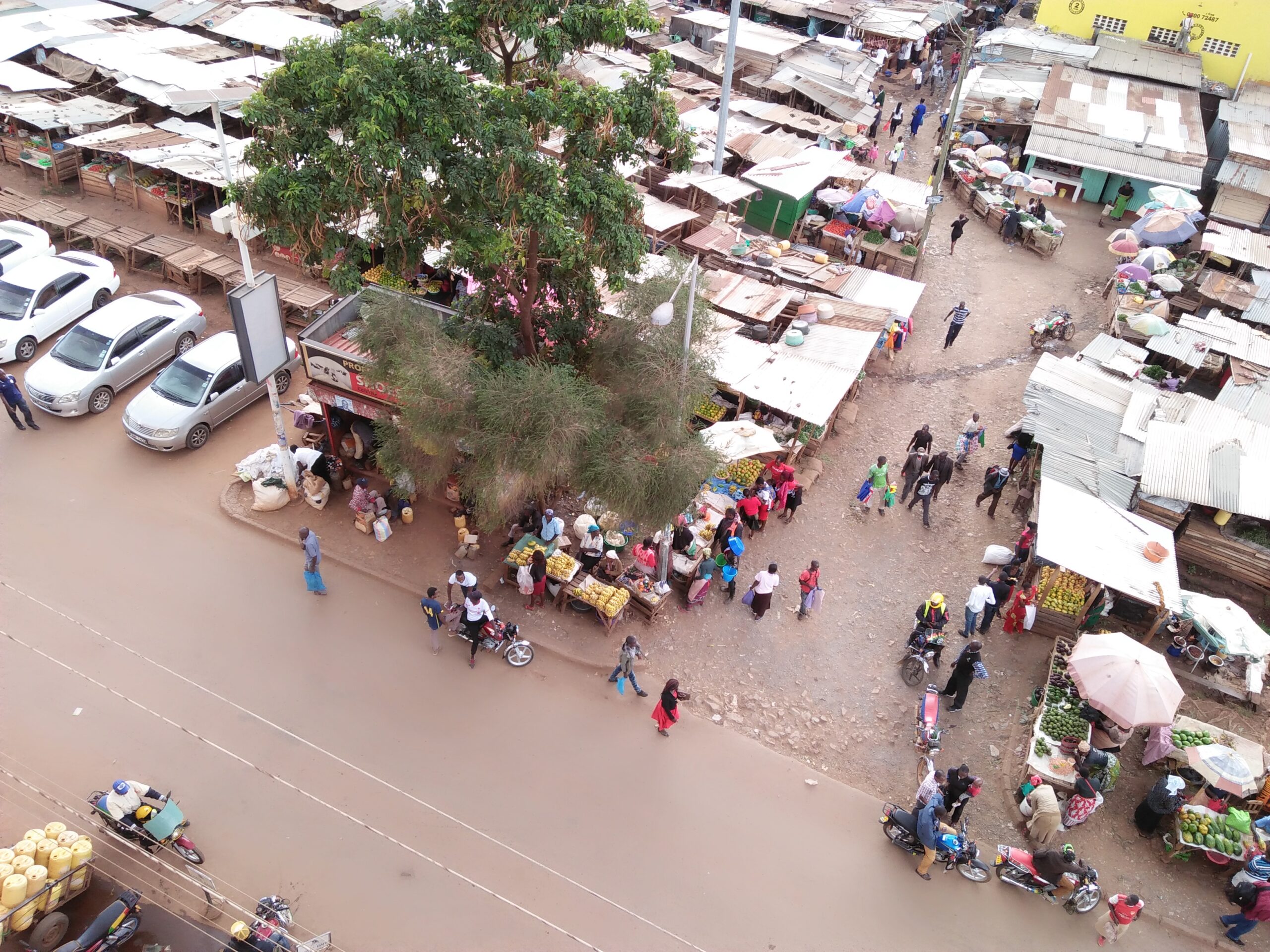
    Marikiti Market in Kisii town, Kenya
    Photo: Wiki Loves Africa 2017 contributor, CC BY-SA 4.0, via Wikimedia Commons

    Kisii town today

    Locally, Kisii town is often called Bosongo or Getembe rather than by its official name, and it’s grown well beyond its trading-post origins into the commercial hub for the whole Gusii Highlands — banks, hospitals, a university campus and Gusii Stadium, the county’s main sports venue, all cluster around the town centre. Tea and dairy farming, alongside the soapstone trade, are the backbone of the local economy; the smallholdings visible on every hillside driving into town are mostly a mix of tea bushes, banana groves and dairy cattle, which is why fresh milk, tea and bananas turn up in nearly every local meal.

    Day trip: Ruma National Park

    Kisii is one of the standard access routes to Ruma National Park in neighbouring Homa Bay County, roughly 65km away – Kenya’s only park in the former Nyanza Province and the last stronghold of the roan antelope in the country, alongside sitatunga, buffalo and a strong bird list along the Lambwe Valley near Lake Victoria. It’s a quiet, uncrowded park by Kenyan standards, and combining it with a Tabaka visit makes a reasonable full day out from Kisii town.

    Food

    Gusii food centres on the highlands’ agricultural base – obokima (a stiff maize-and-millet or maize-and-cassava ugali, denser than the standard maize version) served with omoro (a fermented vegetable stew, often made with pumpkin or cassava leaves) or with meat and vegetable stews. The highlands are also serious tea and dairy country, so fresh milk and tea show up constantly, alongside bananas and sweet potatoes grown on nearly every smallholding in the county. It’s home cooking rather than a restaurant scene – hotel and guesthouse kitchens in Kisii town are the easiest way to try it.

    Getting there

    Kisii sits on the A1 highway and is well connected by road: about 66km (1h30-1h45) from Kisumu, and roughly 340-360km (5-6 hours) from Nairobi via Nakuru and Kericho. Frequent matatus and buses run both routes. There’s also a small chartered airstrip at Suneka, about 9km from town, used mainly by business travellers and mainly reached via Wilson Airport flights from Nairobi rather than scheduled service.

    Best time to visit

    The Gusii Highlands see rain in some form most of the year thanks to their position at the edge of the Lake Victoria basin, so there’s no fully dry season – but the lightest rainfall tends to fall from December to February and again in July, making these the more comfortable windows for a Tabaka visit or a hike in the hills. Temperatures stay mild year-round given the elevation, cooler than Kisumu or the coast.

    FAQ

    Is Kisii worth an overnight, or just a stop? Most visitors treat it as a half-day to full-day stop between Kisumu and the Mara rather than a base for a multi-night stay, though an overnight lets you fit in Tabaka, the Cultural Centre and a Ruma day trip without rushing.

    Do I need a guide to visit Tabaka? Not strictly – workshops are used to visitors – but a local driver or guide makes it easier to see several workshops, understand the carving process, and buy directly from carvers rather than the first roadside stall.

    Is soapstone easy to bring home? Small and medium pieces travel well in checked luggage if wrapped carefully; larger sculptures are heavy, and some shops can arrange shipping.

    Related

  • Rwanda Gorilla Trekking: Permits, Cost and What to Expect

    Rwanda Gorilla Trekking: Permits, Cost and What to Expect

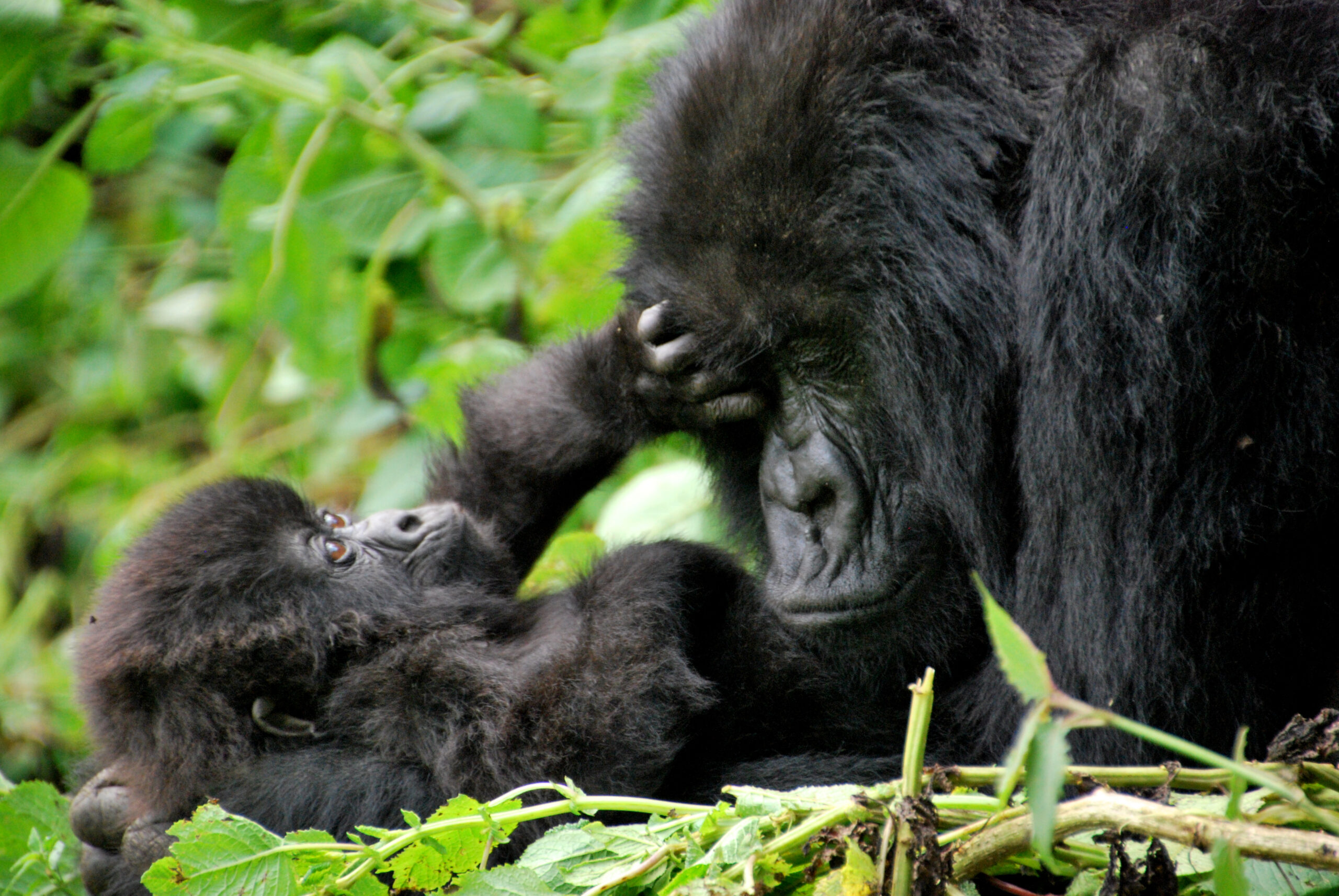
    A mother and baby mountain gorilla in Volcanoes National Park, Rwanda
    Photo: via Wikimedia Commons, CC BY-SA 2.0

    Gorilla trekking is the one safari-adjacent experience in East Africa priced and rationed on purpose — a single permit costs more than most people’s entire safari, and there are only so many issued per day. Knowing the real numbers before you book saves both money and disappointment.

    What a permit costs

    A standard Volcanoes National Park gorilla permit costs $1,500 per person for international visitors, set by the Rwanda Development Board and identical across every operator — nobody discounts the permit itself. African residents and citizens of other African countries qualify for a reduced $500 rate. A conditional low-season discount cuts the standard permit to $1,050 between November and May, but it requires also booking at least two nights at Nyungwe Forest or Akagera National Park.

    What the permit includes

    Park entry, a guide, trackers, and one hour with a habituated gorilla family once you reach them. It does not include transport, accommodation, porters (optional, and worth hiring), or park entry to other reserves.

    How the trek works

    Volcanoes National Park has multiple habituated gorilla families, each capped at eight visitors per day, so total daily permits are limited — book well ahead, especially for July through September and December through February. Trackers locate the family’s overnight position before you set out; the hike itself can run anywhere from two to seven hours round trip depending on where the gorillas have moved.

    When to go

    June through September and December through February are the driest windows, meaning firmer trails and less mud on the volcano slopes. The rainier months outside this are when the low-season permit discount applies, trading trail conditions for a lower price.

    Getting there

    Volcanoes National Park sits near Musanze and Kinigi, roughly two and a half to three hours by road from Kigali. Most operators arrange the transfer as part of a broader itinerary.

    Who can trek

    The minimum age is 15. This makes gorilla trekking one of the harder East Africa experiences to build into a family trip with younger children — see our family safari guide for age-appropriate alternatives if traveling with kids under 15.

    FAQ

    Is Uganda cheaper for gorilla trekking? Yes — Uganda’s Bwindi and Mgahinga permits run lower than Rwanda’s, though travel time from Kampala to the parks is typically longer than from Kigali to Volcanoes National Park.

    How far ahead should I book? Permits sell out for peak months, so book several months ahead for June–September and December–February travel.

    Do I need a visa for Rwanda? Check current requirements before booking — several African passport holders qualify for visa-free or visa-on-arrival entry. See our visa-free destinations guide.

    Related

  • Diani Beach After a Safari: Adding Kenya’s Coast to Your Trip

    Diani Beach After a Safari: Adding Kenya’s Coast to Your Trip

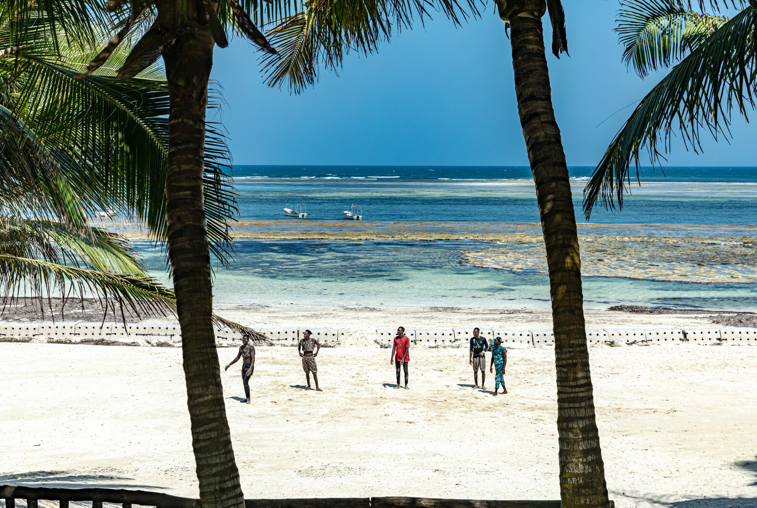
    Diani Beach, Kenya, on the Indian Ocean coast
    Photo: Ninara, CC BY 2.0, via Wikimedia Commons

    A week of game drives is dust, early alarms and long hours in a vehicle — great value for the wildlife, hard on the body. Tacking on a few days at Diani Beach afterward is one of the most common ways Kenya trips get extended, and the logistics are simpler than they look.

    Why Diani works as a safari add-on

    Diani sits on Kenya’s south coast near Mombasa: white sand, a barrier reef that keeps the water calm, and a well-developed strip of resorts and independent hotels. It’s a genuine change of pace from a safari camp — flat, warm, and built for doing very little.

    Getting from the Mara or Amboseli to Diani

    Direct light-aircraft routes connect the Mara and Amboseli to Ukunda airstrip, Diani’s local airport, without routing back through Nairobi — typically the fastest option and worth checking first. The alternative is flying into Nairobi, connecting to Mombasa’s Moi International Airport, then a 45-minute transfer south to Diani.

    When to go

    December through March and July through September are the driest, most reliable windows on the coast, avoiding the long rains (April–May) and short rains (November). These overlap well with peak safari season, which makes back-to-back planning straightforward.

    How many days

    Three to four nights is enough to properly unwind without eating into safari time — enough for beach days, a snorkeling or dhow trip, and one slower day doing nothing at all.

    Before you go

    Set up connectivity before you land rather than on arrival — see our eSIM guide for Kenya, Tanzania and South Africa for options that work at both the safari camp and the coast.

    FAQ

    Is Diani safe and set up for tourists? Yes — it’s one of Kenya’s most established beach destinations, with a wide range of resorts, restaurants and tour operators.

    Should I fly direct to Diani or via Mombasa? Ukunda airstrip serves Diani directly on many routes from safari areas; Moi International in Mombasa has more international connections but adds a transfer.

    Related

  • Amboseli vs Maasai Mara: Which Kenya Safari Park Should You Choose

    Amboseli vs Maasai Mara: Which Kenya Safari Park Should You Choose

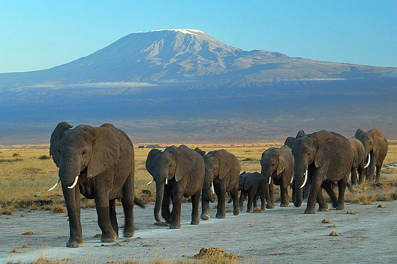
    Elephants at Amboseli National Park with Mount Kilimanjaro in the background, Kenya
    Photo: Amoghavarsha JS, CC BY-SA 3.0, via Wikimedia Commons

    Most first-time safari travelers narrow their Kenya trip down to these two parks, then get stuck choosing between them. They reward different things — the Mara is about volume and predator drama, Amboseli is about elephants and a single unbeatable backdrop.

    The core difference

    The Maasai Mara has the highest density and diversity of wildlife in Kenya, plus the Great Migration for part of the year. Amboseli has smaller overall game numbers but is built around two things the Mara can’t offer: large, easily observed elephant herds, and open views of Mount Kilimanjaro across the Tanzanian border on clear mornings.

    Pick the Mara if…

    You want the widest range of species in the fewest days, you’re visiting July through October and want a shot at a river crossing, or this is a one-park trip and you want the classic, highest-density safari experience.

    Pick Amboseli if…

    Photography is a priority — elephant herds against Kilimanjaro is one of Africa’s most recognizable shots — you want a shorter drive from Nairobi (around four hours by road versus five to six for the Mara), or you’re combining a safari with Nairobi and want something closer to base.

    Or do both

    Many itineraries combine the two: a few nights in Amboseli for elephants and the Kilimanjaro backdrop, then a light-aircraft transfer to the Mara for volume and predators. It adds cost and a travel day, but avoids the either/or entirely.

    Practical differences

    Getting there. Amboseli is reachable by road from Nairobi in around four hours, or a 45-minute flight. The Mara is five to six hours by road, or roughly 45 minutes to an hour by air from Wilson Airport.

    Crowds. Amboseli sees fewer visitors than the Mara’s main reserve, particularly outside July–October.

    With children. Both parks work for family safaris, though camp choice matters more than park choice — see our family safari guide for age-appropriate options.

    FAQ

    Which is better for a first safari? The Mara, if you only have time for one park — it offers the broadest range of wildlife. Amboseli is a strong second park or a good choice if elephants and Kilimanjaro photography matter more to you than raw species count.

    Can I see the Great Migration from Amboseli? No — the migration moves through the Mara-Serengeti ecosystem, not Amboseli. See our Mara migration month-by-month guide for timing.

    Related

  • Maasai Mara Great Migration: A Month-by-Month River Crossing Guide

    Maasai Mara Great Migration: A Month-by-Month River Crossing Guide

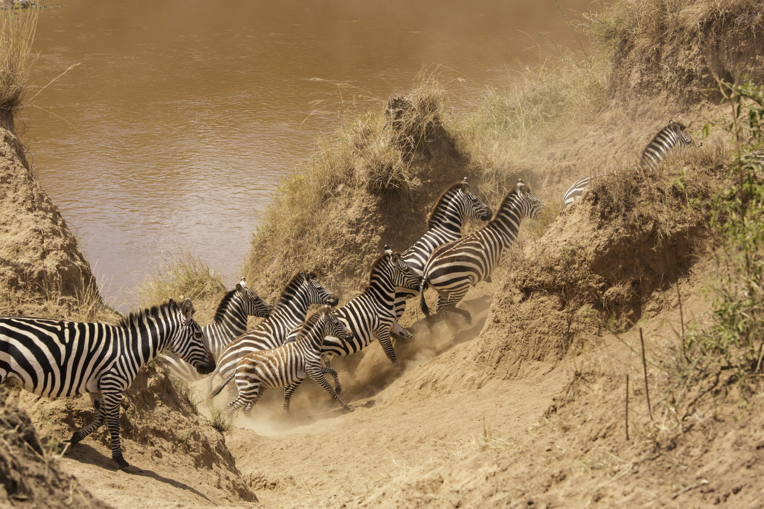
    Zebra crossing the Mara River during the Great Migration, Masai Mara National Reserve, Kenya
    Photo: Tomer T, CC BY-SA 4.0, via Wikimedia Commons

    Everyone plans a Mara trip around “the migration,” but the migration is not one event — it is a slow, months-long loop of grazing and river crossings, and where the herds are changes by the week. Booking around the calendar rather than the calendar year makes the difference between a good game drive and a Mara River crossing you remember for life.

    How the migration actually moves

    Roughly two million wildebeest, plus zebra and gazelle, follow rainfall in a clockwise loop between Tanzania’s Serengeti and Kenya’s Maasai Mara. They are not on a fixed schedule — rainfall timing shifts the herds earlier or later each year — but the broad pattern repeats annually.

    Month by month

    November – December. Herds head south into the Serengeti’s southern plains, drawn by the short rains. Little migration activity in the Mara itself, though resident wildlife viewing stays strong.

    January – March. Calving season in the southern Serengeti, well outside the Mara. Not the window for Kenya migration viewing, but a strong season for general Mara game drives with fewer crowds.

    April – May. Long rains across the ecosystem. Herds are on the move north but rarely reach the Mara yet. Lodge rates drop significantly in this shoulder season.

    June – July. The herds push north through the western Serengeti corridor and start reaching the Mara River. Late June into July typically brings the first crossings — chaotic, crocodile-watched fords that are the classic “migration” image.

    August – September. Peak season. The bulk of the herd is grazing across the Mara’s plains and conservancies, with crossings happening on and off throughout. This is also peak pricing and peak crowds at the main river crossing points.

    October. Herds begin drifting back south as the Mara dries out, with crossings continuing in the first half of the month before movement south picks up.

    Where to base yourself

    Camps inside the conservancies bordering the reserve tend to have fewer vehicles per sighting and more flexible game-drive rules than camps inside the main reserve boundary, which matters most during the July–October crush. See our guide to Africa’s ultra-luxury safari camps for specific picks.

    FAQ

    Is the migration guaranteed if I visit in August? No sighting in the wild is guaranteed, but August through September is the most reliable window for both herd presence and river crossings.

    Is the Mara worth visiting outside migration months? Yes — resident lion, elephant and giraffe populations mean strong game viewing year-round, and shoulder months bring lower rates and fewer vehicles. See our month-by-month East Africa safari guide for the wider picture beyond the Mara alone.

    Related

  • Siaya Travel Guide: Lake Victoria’s Quiet Shore

    Siaya Travel Guide: Lake Victoria’s Quiet Shore

    Lake Victoria, the freshwater lake bordering Siaya County, Kenya

    Siaya County sits on the northern shore of Lake Victoria, just north of Kisumu, and it stays almost entirely off the standard Kenya itinerary – which is exactly what makes it worth a detour for travellers who’ve already done the safari-and-coast circuit.

    Why visit Siaya

    Most Lake Victoria visits get associated with Kisumu city, but Siaya has its own stretch of shoreline plus the second-largest oxbow lake in Africa – Lake Kanyaboli – inside the Yala Swamp wetland complex, an important bird area with over 400 recorded species and a refuge for the endangered sitatunga antelope. The Yala Swamp is also Kenya’s largest freshwater wetland, formed where the Yala and Nzoia rivers empty into Lake Victoria, and it acts as a natural filter for water flowing into the lake.

    Things to do

    Kogelo. The ancestral home village of Barack Obama Sr., about 40km from Kisumu. A cultural centre and the family homestead draw a steady trickle of visitors, and it doubles as a window into rural Luo village life beyond the headline.

    Road near Nyang'oma Kogelo, Siaya County, Kenya
    Photo: Omondi, CC BY-SA 4.0, via Wikimedia Commons

    Lake Kanyaboli and the Yala Swamp. Boat trips through papyrus wetlands for birdwatching, with species like the papyrus gonolek and papyrus yellow warbler found in few other places in Kenya. The lake also shelters fish species that have all but disappeared from Lake Victoria itself, making it an important refuge as well as a scenic stop.

    Papyrus wetland at Lake Kanyaboli in the Yala Swamp, Siaya County, Kenya
    Photo: Omondi, CC BY-SA 4.0, via Wikimedia Commons

    Got Ramogi. A hill of major cultural and spiritual significance to the Luo community, about 40 minutes from Bondo, with panoramic views over the Lake Victoria basin. In Luo oral history it is linked to Ramogi Ajwang, the ancestral figure many Luo communities trace their settlement in the area back to.

    Jaramogi Oginga Odinga Mausoleum. In Bondo, a cultural and historical site honouring Kenya’s first Vice President – part community museum, part Luo heroes exhibition, and a good stop for understanding the region’s role in Kenya’s independence-era politics.

    Luanda K’Otieno Pier. The springboard to Lake Victoria’s smaller islands, including Mfangano and Rusinga – old-fashioned ferry crossings rather than a polished tourist operation, and a good look at how people actually move around the lake.

    Siaya town and everyday life

    Siaya town itself is a small, workaday county headquarters rather than a tourist stop – a market street, government offices, a handful of guesthouses and matatu stages. It’s a useful staging point if you’re heading further into rural Alego or Ugenya, but most travellers pass through rather than linger. The county’s real texture is in its villages: homesteads spread across low hills, sugarcane and maize fields, and fish landing sites along the lakeshore at places like Usenge and Ndori, where the day’s catch comes in by dugout and wooden boat each morning.

    A bit of history

    Siaya County – and Alego location in particular – carries outsized weight in Kenyan political history. It’s the home area of Jaramogi Oginga Odinga, Kenya’s first Vice President and a defining figure of the independence era, and of his son Raila Odinga, who shaped national politics for decades after him. That legacy is part of why Bondo’s mausoleum draws more visitors than its size would suggest, and why the region is often described, only half-jokingly, as the heartland of opposition politics in Kenya. Long before that, this was Luo settlement country, part of a migration and settlement history that oral tradition – centred on figures like Ramogi Ajwang at Got Ramogi – traces back several centuries to origins further north along the Nile basin.

    What to eat

    Siaya shares the Luo Nyanza food culture centred on the lake. Fish is central – tilapia and Nile perch grilled or stewed, and omena (silver cyprinid, a small lake sardine) dried and fried, often eaten with ugali. Traditional greens like osuga, apoth and mrenda (jute mallow) are cooked down with a little omena or groundnut paste and served alongside. It’s simple, fresh, lake-and-farm food rather than a restaurant scene – your best introduction to it is usually wherever you’re staying in Kisumu, or a home-cooked meal if a local guide or homestay can arrange one.

    Got Ramogi, in more depth

    Got Ramogi deserves more than a passing mention on the itinerary. Luo oral history holds that this hill in East Yimbo was the first point of settlement for Ramogi Ajwang’, the community’s founding ancestor, after the Luo migrated south from South Sudan through Uganda — a dating oral historians place around 1425 AD. The hill is scattered with hembko (shrines), sacred trees and old meeting sites where elders once gathered in council, and it still draws Luo visitors from Siaya, Kisumu, Homa Bay and Migori counties for cultural festivals and, for members of the Legio Maria church, regular prayer gatherings. It functions less like a single monument and more like a living, still-used sacred landscape — treat a visit as a chance to learn the history from a local guide rather than a quick photo stop.

    A simple 2-day plan

    Day 1. Base yourself in Kisumu, drive to Kogelo in the morning, then continue to Got Ramogi and the Jaramogi Oginga Odinga Mausoleum in Bondo in the afternoon.

    Day 2. Boat trip onto Lake Kanyaboli and the Yala Swamp for birdwatching, or head to Luanda K’Otieno Pier if you want to continue on to Mfangano or Rusinga Island.

    Best time to visit

    As with the rest of the Lake Victoria basin, the driest and most pleasant windows for boat trips and birdwatching fall around June-September and January-February.

    Getting there

    Siaya is a short drive north-west of Kisumu, making it a natural add-on to a Kisumu trip rather than a standalone destination – most visitors base themselves in Kisumu and day-trip out to Kogelo, Got Ramogi or the Yala Swamp.

    FAQ

    Can I visit Kogelo without a private guide? It’s possible by public transport via Kisumu, but a local driver or guide makes navigating the rural roads and arranging homestead access considerably easier.

    Is Siaya set up for tourism? Not heavily – infrastructure is limited compared with Kisumu, which is part of the appeal for travellers wanting an unpolished, off-circuit experience.

    How do I arrange a Yala Swamp boat trip? Local operators and guides based around the swamp and Lake Kanyaboli run boat trips on request – arranging one through your Kisumu accommodation or a local guide is usually more reliable than turning up unannounced.

    Related