Author: Stephen Ahenda

  • Maasai Mara Great Migration: A Month-by-Month River Crossing Guide

    Maasai Mara Great Migration: A Month-by-Month River Crossing Guide

    Kenya

    Maasai Mara Great Migration: A Month-by-Month River Crossing Guide

    Everyone plans a Mara trip around “the migration,” but the migration is not one event — it is a slow, months-long loop of grazing and river crossings, and where the herds are changes by the week. Booking around the calendar rather than the calendar year makes the difference between a good game drive and a Mara River crossing you remember for life.
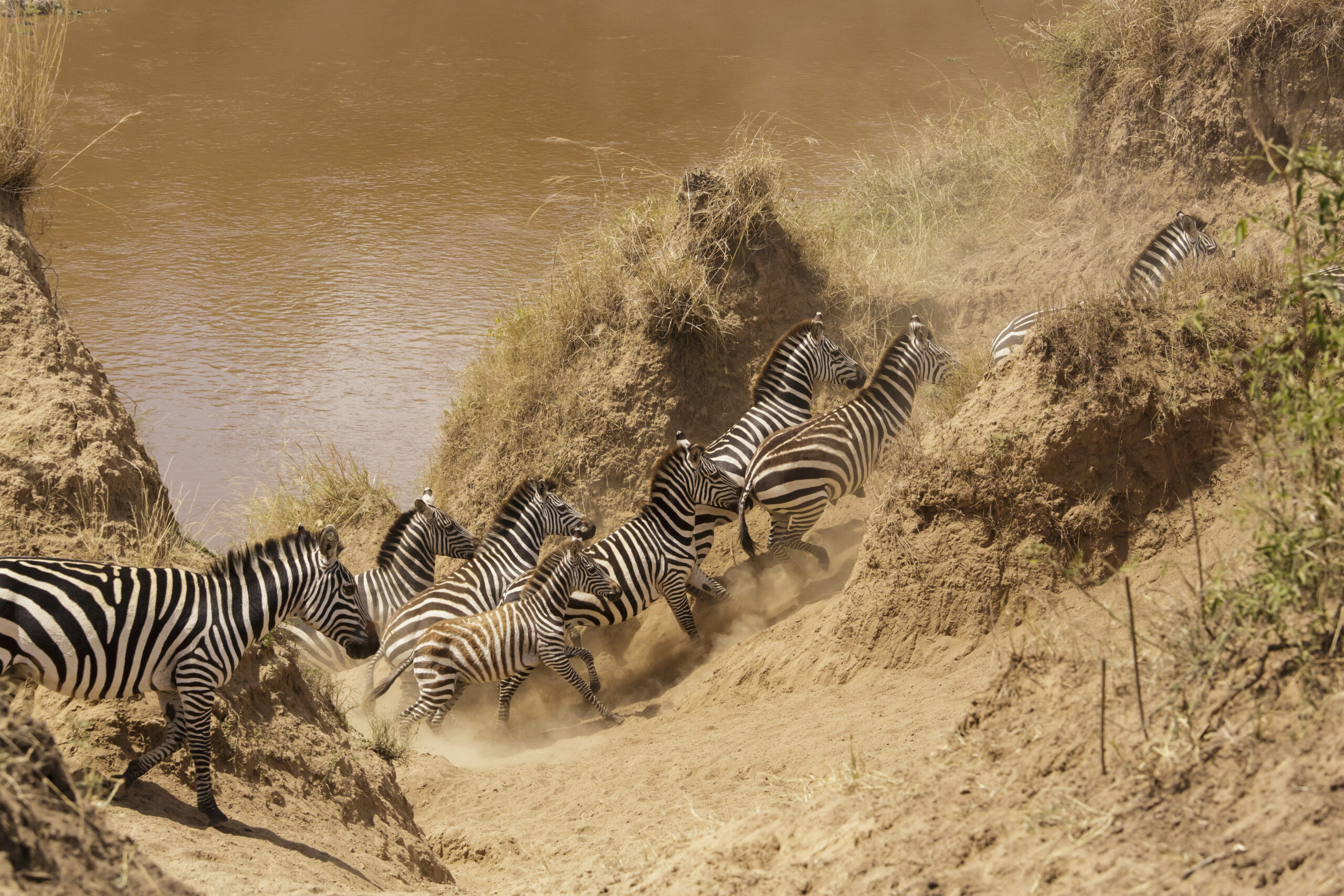
    Zebra crossing the Mara River during the Great Migration, Masai Mara National Reserve, Kenya
    Photo: Tomer T, CC BY-SA 4.0, via Wikimedia Commons
    Migration

    How the migration actually moves

    Roughly two million wildebeest, plus zebra and gazelle, follow rainfall in a clockwise loop between Tanzania’s Serengeti and Kenya’s Maasai Mara. They are not on a fixed schedule — rainfall timing shifts the herds earlier or later each year — but the broad pattern repeats annually.

    Month by month

    Month by month

    November – December. Herds head south into the Serengeti’s southern plains, drawn by the short rains. Little migration activity in the Mara itself, though resident wildlife viewing stays strong.

    January – March. Calving season in the southern Serengeti, well outside the Mara. Not the window for Kenya migration viewing, but a strong season for general Mara game drives with fewer crowds.

    April – May. Long rains across the ecosystem. Herds are on the move north but rarely reach the Mara yet. Lodge rates drop significantly in this shoulder season.

    June – July. The herds push north through the western Serengeti corridor and start reaching the Mara River. Late June into July typically brings the first crossings — chaotic, crocodile-watched fords that are the classic “migration” image.

    August – September. Peak season. The bulk of the herd is grazing across the Mara’s plains and conservancies, with crossings happening on and off throughout. This is also peak pricing and peak crowds at the main river crossing points.

    October. Herds begin drifting back south as the Mara dries out, with crossings continuing in the first half of the month before movement south picks up.

    Guide

    Where to base yourself

    Camps inside the conservancies bordering the reserve tend to have fewer vehicles per sighting and more flexible game-drive rules than camps inside the main reserve boundary, which matters most during the July–October crush. See our guide to Africa’s ultra-luxury safari camps for specific picks.
    Good to know

    Frequently asked questions

    No sighting in the wild is guaranteed, but August through September is the most reliable window for both herd presence and river crossings.
    Yes — resident lion, elephant and giraffe populations mean strong game viewing year-round, and shoulder months bring lower rates and fewer vehicles. See our month-by-month East Africa safari guide for the wider picture beyond the Mara alone.

    Ready to plan your trip?

    Compare flights and hotels in one search.

  • Siaya Travel Guide: Lake Victoria’s Quiet Shore

    Siaya Travel Guide: Lake Victoria’s Quiet Shore

    Kenya

    Siaya Travel Guide: Lake Victoria’s Quiet Shore

    Siaya County sits on the northern shore of Lake Victoria, just north of Kisumu, and it stays almost entirely off the standard Kenya itinerary – which is exactly what makes it worth a detour for travellers who’ve already done the safari-and-coast circuit.

    Lake Victoria, the freshwater lake bordering Siaya County, Kenya
    Why visit

    Why visit Siaya

    Most Lake Victoria visits get associated with Kisumu city, but Siaya has its own stretch of shoreline plus the second-largest oxbow lake in Africa – Lake Kanyaboli – inside the Yala Swamp wetland complex, an important bird area with over 400 recorded species and a refuge for the endangered sitatunga antelope. The Yala Swamp is also Kenya’s largest freshwater wetland, formed where the Yala and Nzoia rivers empty into Lake Victoria, and it acts as a natural filter for water flowing into the lake.

    Things to do

    Things to do

    Kogelo. The ancestral home village of Barack Obama Sr., about 40km from Kisumu. A cultural centre and the family homestead draw a steady trickle of visitors, and it doubles as a window into rural Luo village life beyond the headline.

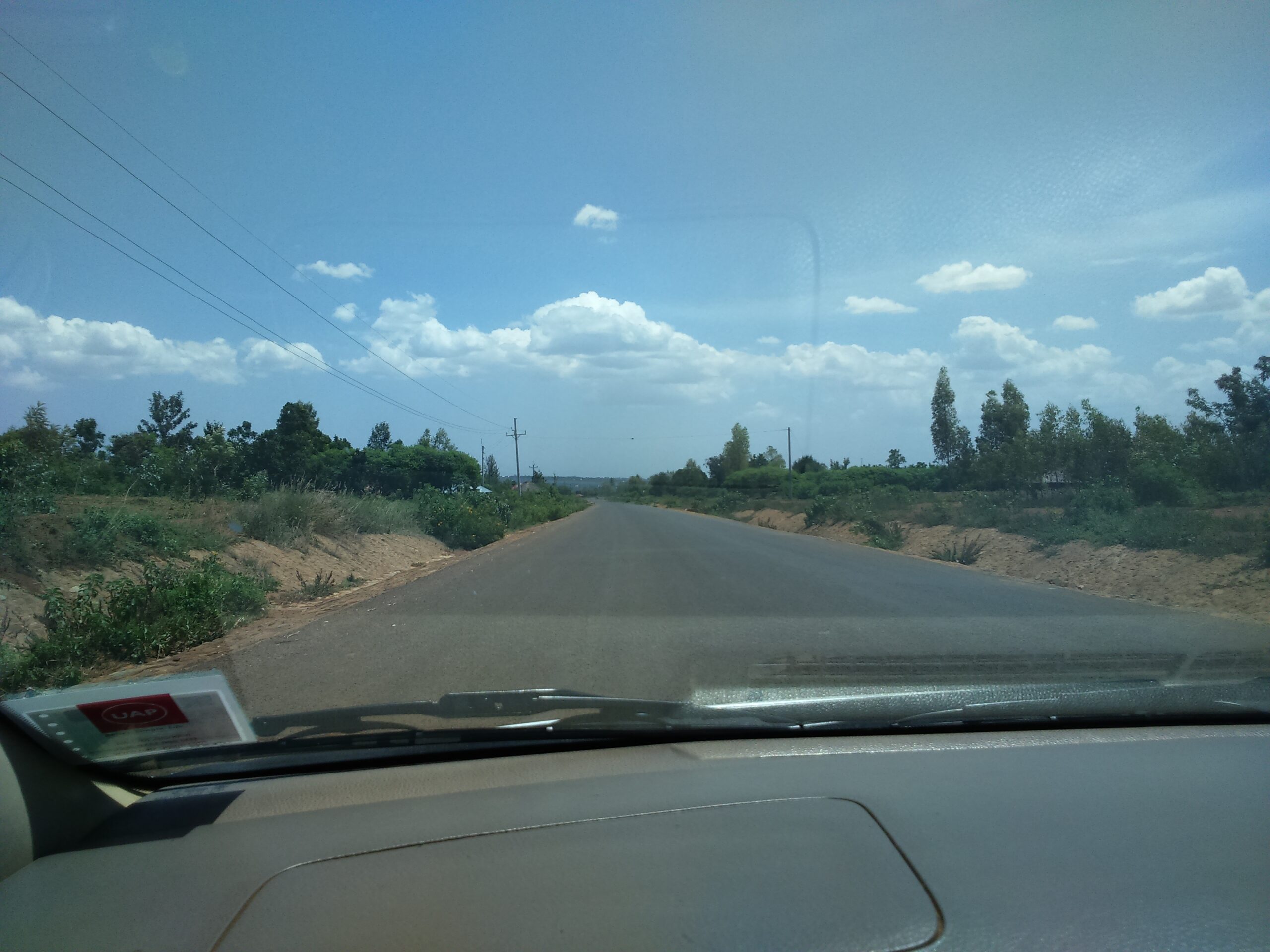
    Road near Nyang'oma Kogelo, Siaya County, Kenya
    Photo: Omondi, CC BY-SA 4.0, via Wikimedia Commons

    Lake Kanyaboli and the Yala Swamp. Boat trips through papyrus wetlands for birdwatching, with species like the papyrus gonolek and papyrus yellow warbler found in few other places in Kenya. The lake also shelters fish species that have all but disappeared from Lake Victoria itself, making it an important refuge as well as a scenic stop.

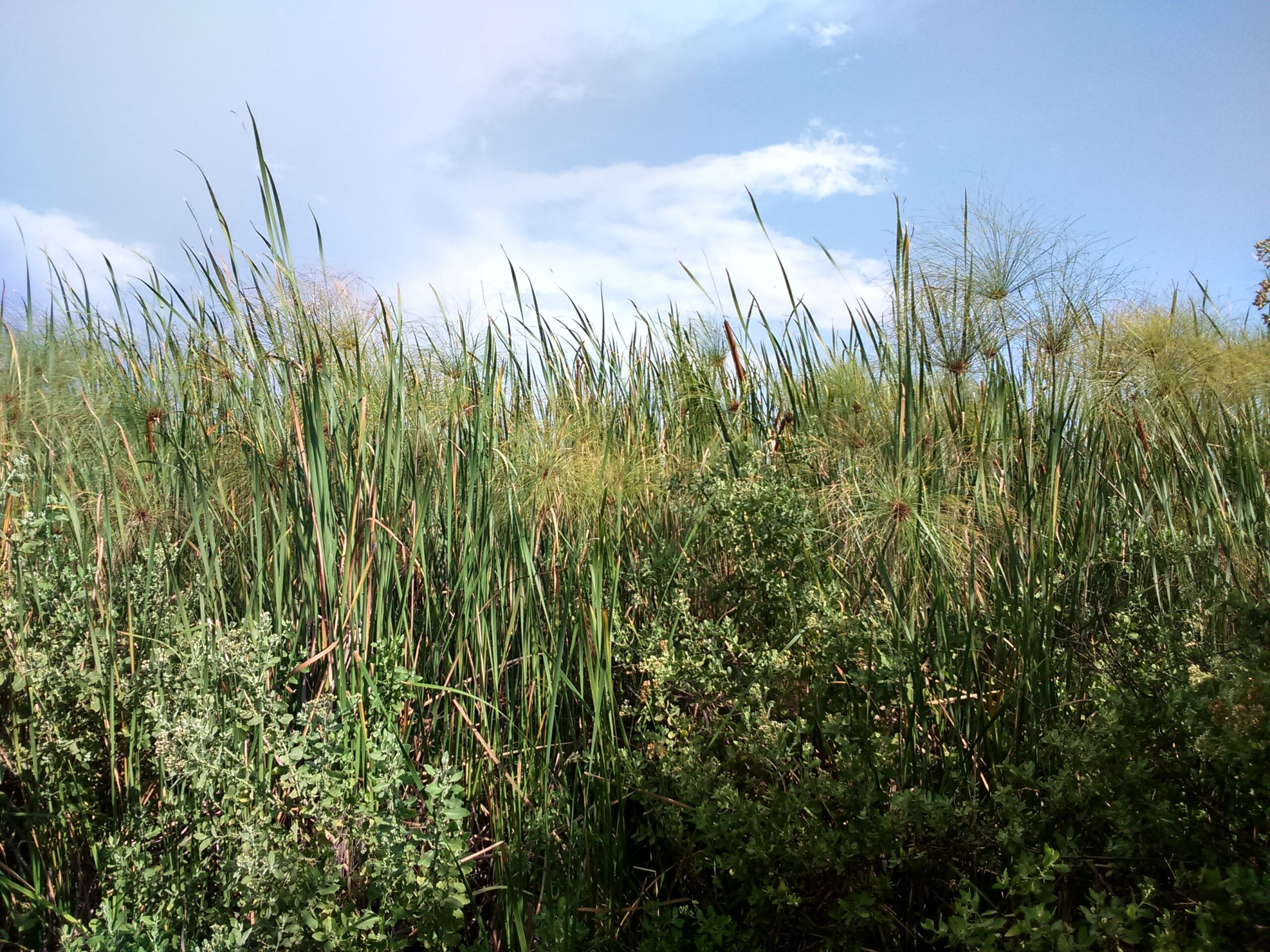
    Papyrus wetland at Lake Kanyaboli in the Yala Swamp, Siaya County, Kenya
    Photo: Omondi, CC BY-SA 4.0, via Wikimedia Commons

    Got Ramogi. A hill of major cultural and spiritual significance to the Luo community, about 40 minutes from Bondo, with panoramic views over the Lake Victoria basin. In Luo oral history it is linked to Ramogi Ajwang, the ancestral figure many Luo communities trace their settlement in the area back to.

    Jaramogi Oginga Odinga Mausoleum. In Bondo, a cultural and historical site honouring Kenya’s first Vice President – part community museum, part Luo heroes exhibition, and a good stop for understanding the region’s role in Kenya’s independence-era politics.

    Luanda K’Otieno Pier. The springboard to Lake Victoria’s smaller islands, including Mfangano and Rusinga – old-fashioned ferry crossings rather than a polished tourist operation, and a good look at how people actually move around the lake.

    Guide

    Siaya town and everyday life

    Siaya town itself is a small, workaday county headquarters rather than a tourist stop – a market street, government offices, a handful of guesthouses and matatu stages. It’s a useful staging point if you’re heading further into rural Alego or Ugenya, but most travellers pass through rather than linger. The county’s real texture is in its villages: homesteads spread across low hills, sugarcane and maize fields, and fish landing sites along the lakeshore at places like Usenge and Ndori, where the day’s catch comes in by dugout and wooden boat each morning.

    Heritage

    A bit of history

    Siaya County – and Alego location in particular – carries outsized weight in Kenyan political history. It’s the home area of Jaramogi Oginga Odinga, Kenya’s first Vice President and a defining figure of the independence era, and of his son Raila Odinga, who shaped national politics for decades after him. That legacy is part of why Bondo’s mausoleum draws more visitors than its size would suggest, and why the region is often described, only half-jokingly, as the heartland of opposition politics in Kenya. Long before that, this was Luo settlement country, part of a migration and settlement history that oral tradition – centred on figures like Ramogi Ajwang at Got Ramogi – traces back several centuries to origins further north along the Nile basin.

    Guide

    What to eat

    Siaya shares the Luo Nyanza food culture centred on the lake. Fish is central – tilapia and Nile perch grilled or stewed, and omena (silver cyprinid, a small lake sardine) dried and fried, often eaten with ugali. Traditional greens like osuga, apoth and mrenda (jute mallow) are cooked down with a little omena or groundnut paste and served alongside. It’s simple, fresh, lake-and-farm food rather than a restaurant scene – your best introduction to it is usually wherever you’re staying in Kisumu, or a home-cooked meal if a local guide or homestay can arrange one.

    Guide

    Got Ramogi, in more depth

    Got Ramogi deserves more than a passing mention on the itinerary. Luo oral history holds that this hill in East Yimbo was the first point of settlement for Ramogi Ajwang’, the community’s founding ancestor, after the Luo migrated south from South Sudan through Uganda — a dating oral historians place around 1425 AD. The hill is scattered with hembko (shrines), sacred trees and old meeting sites where elders once gathered in council, and it still draws Luo visitors from Siaya, Kisumu, Homa Bay and Migori counties for cultural festivals and, for members of the Legio Maria church, regular prayer gatherings. It functions less like a single monument and more like a living, still-used sacred landscape — treat a visit as a chance to learn the history from a local guide rather than a quick photo stop.

    Itinerary

    A simple 2-day plan

    Day 1. Base yourself in Kisumu, drive to Kogelo in the morning, then continue to Got Ramogi and the Jaramogi Oginga Odinga Mausoleum in Bondo in the afternoon.

    Day 2. Boat trip onto Lake Kanyaboli and the Yala Swamp for birdwatching, or head to Luanda K’Otieno Pier if you want to continue on to Mfangano or Rusinga Island.

    When to go

    Best time to visit

    As with the rest of the Lake Victoria basin, the driest and most pleasant windows for boat trips and birdwatching fall around June-September and January-February.

    Getting there

    Getting there

    Siaya is a short drive north-west of Kisumu, making it a natural add-on to a Kisumu trip rather than a standalone destination – most visitors base themselves in Kisumu and day-trip out to Kogelo, Got Ramogi or the Yala Swamp.

    Good to know

    Frequently asked questions

    It’s possible by public transport via Kisumu, but a local driver or guide makes navigating the rural roads and arranging homestead access considerably easier.
    Not heavily – infrastructure is limited compared with Kisumu, which is part of the appeal for travellers wanting an unpolished, off-circuit experience.
    Local operators and guides based around the swamp and Lake Kanyaboli run boat trips on request – arranging one through your Kisumu accommodation or a local guide is usually more reliable than turning up unannounced.

    Ready to plan your trip?

    Compare flights and hotels in one search.

  • Bomet Travel Guide: Kenya’s South Rift Tea Country

    Bomet Travel Guide: Kenya’s South Rift Tea Country

    Kenya

    Bomet Travel Guide: Kenya’s South Rift Tea Country

    Bomet County sits in Kenya’s South Rift, wedged between the Mau Forest complex and the Maasai Mara – a green, hilly stretch of tea country that most safari itineraries drive straight through on the way to the Mara without stopping.

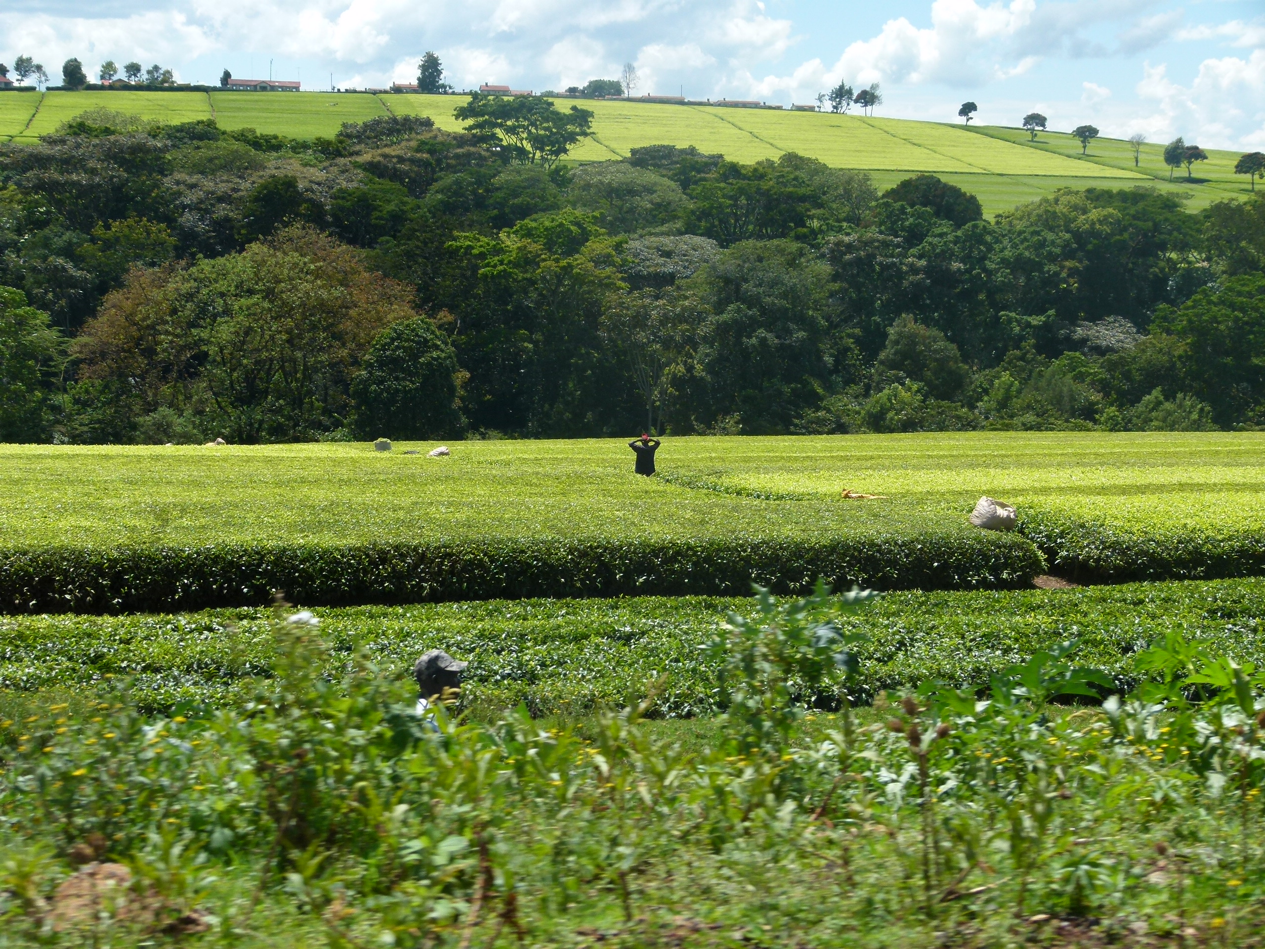
    Tea plantations in the Kericho-Bomet tea country, South Rift, Kenya
    Why visit

    Why visit Bomet

    Bomet is Kipsigis heartland, and its rolling tea plantations run into neighbouring Kericho County to form one of Kenya’s most photogenic agricultural landscapes. It borders the Mau Forest Complex – the largest closed-canopy indigenous forest in Kenya and a key water catchment for Lake Victoria and the White Nile – so the county doubles as a gateway to forest walks and birding as well as tea-country scenery.

    Heritage

    A little history and culture

    Commercial tea arrived in the Kericho-Bomet highlands under British colonial estates in the early 1900s, drawn by the cool climate and reliable rainfall of the Mau escarpment – the same conditions that make the region so green today. The Kipsigis, a Kalenjin-speaking community and Kenya’s largest Kalenjin subgroup, are the majority in Bomet, with a strong pastoral and now smallholder-farming tradition; mursik, a fermented milk stored in a smoked gourd, is a Kalenjin staple worth trying if it’s offered at a homestay or farm visit.

    Culture

    The Kipsigis age-set system

    Kipsigis society, like other Kalenjin groups, has traditionally been organised around ipinda – a cyclical age-set system that grouped people initiated in the same period into named generations (Maina, Nyongi, Chumiot, Saweiyiek, Korongoro, Kipkoimet, Kaplelach and Kipnyiige, repeating roughly every century). Initiation, tumdo, marked the passage from childhood into a named age-set with its own responsibilities, and the system shaped everything from warriorhood and land rights to who could marry whom. It’s a less visible layer of Bomet’s culture than the tea estates, but it’s the social architecture underneath the farmland – and a good local guide or homestay host can explain how much of it still shapes community life today, even as the warrior age-grades of the past have given way to schooling, farming and, for a striking number of Kipsigis, world-class distance running.

    Things to do

    Things to do

    Tea plantation visits. Kenya has launched dedicated tea tourism around Bomet and neighbouring Kericho, with working estates opening up to visitors for tours and tastings among the tea bushes – a good half-day that also explains how the leaves in your morning cup actually get picked and processed.

    Chepalungu Forest. A lesser-known forest reserve with walking trails and strong birdlife – a quiet contrast to the county’s farmland, and one of the more accessible patches of indigenous forest in the South Rift.

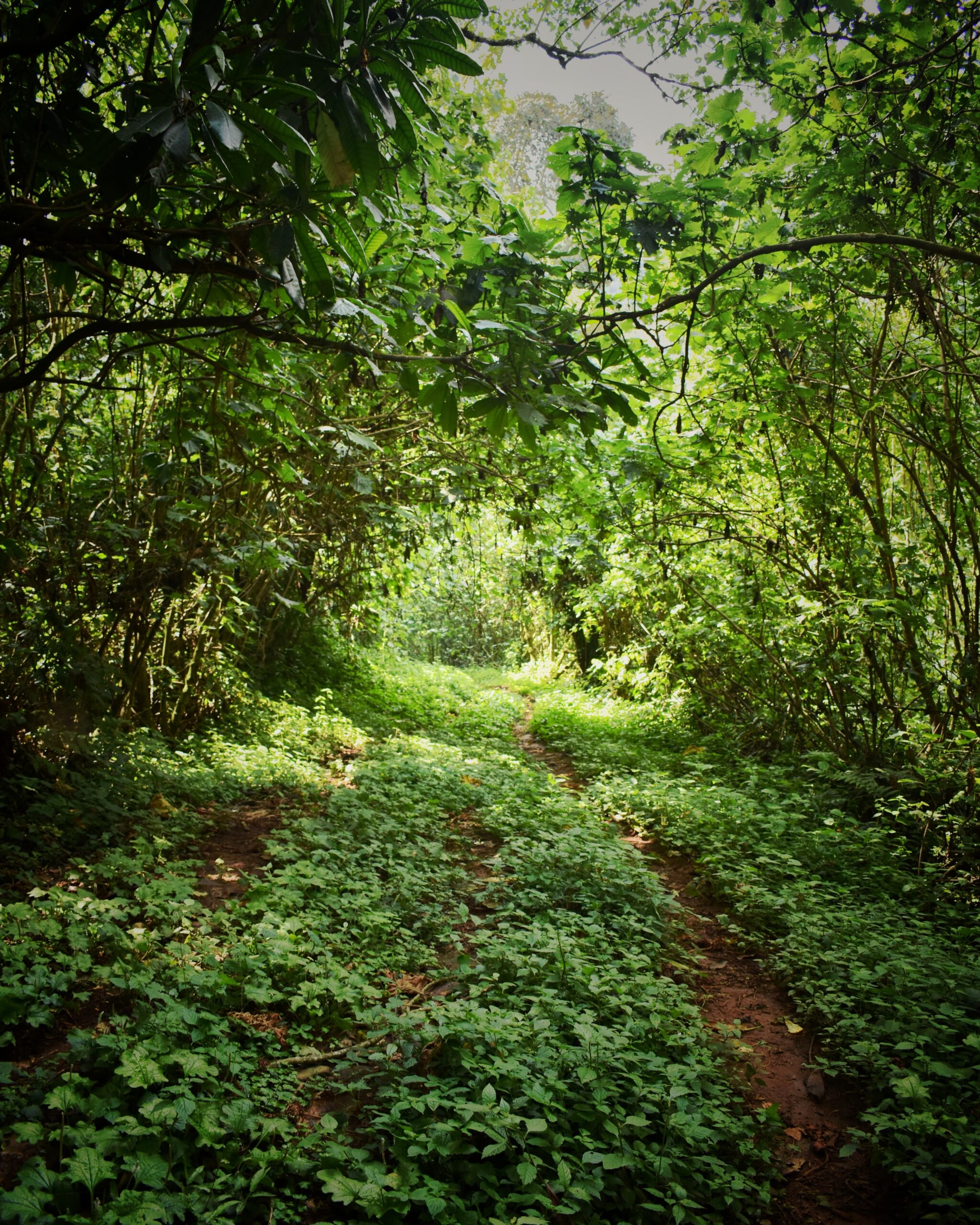
    Inside the Mau Forest complex near Bomet, Kenya
    Photo: Bett Duncan, CC BY-SA 4.0, via Wikimedia Commons

    Tenwek Falls. A waterfall stop near Tenwek Hospital, a well-known mission hospital that has anchored the area for decades – an easy add-on if you’re passing through the south of the county.

    South Western Mau Forest. Part of the wider Mau Forest Complex, offering forest access and river valleys without the crowds of a national park.

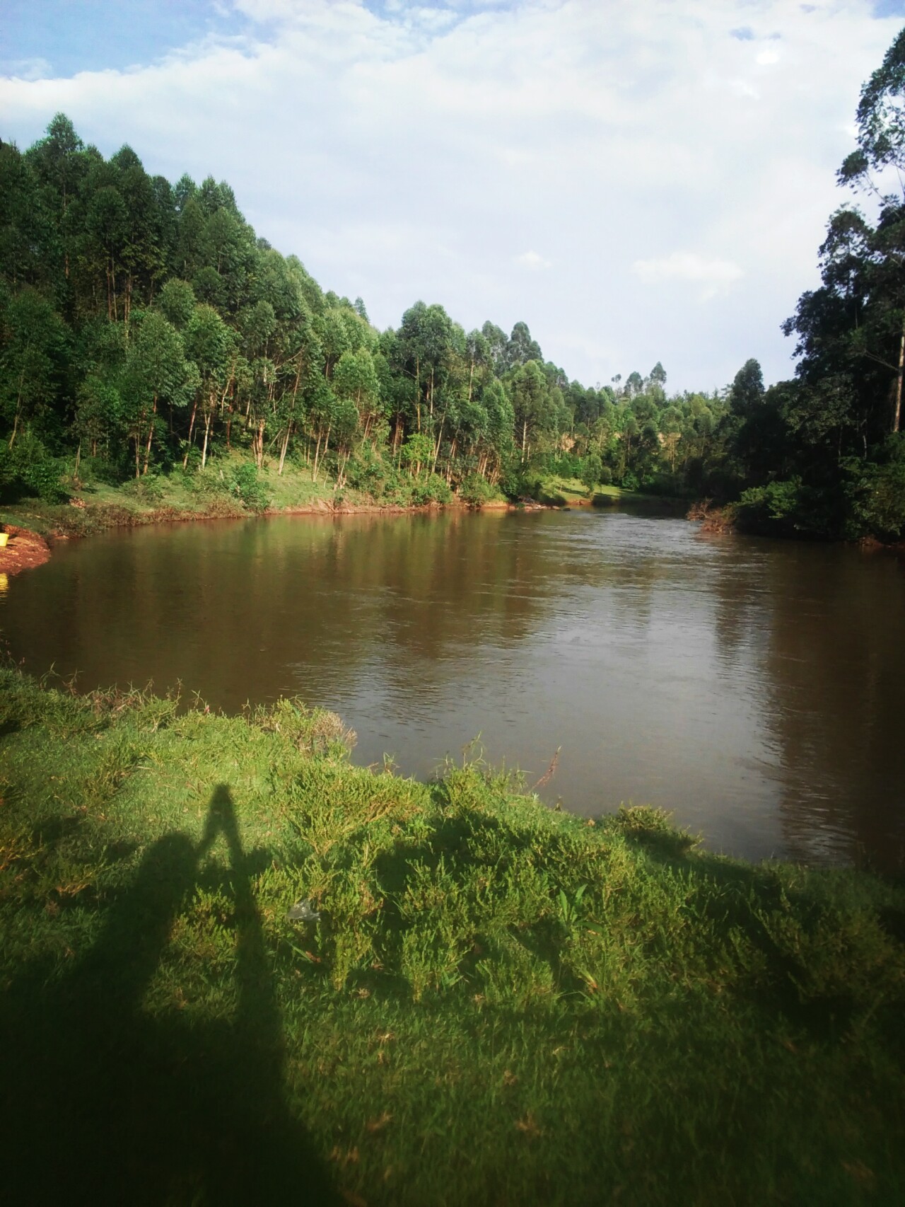
    River Kipranye in the Kericho-Bomet tea highlands, Kenya
    Photo: Kibitok Matty, CC BY-SA 4.0, via Wikimedia Commons

    Onward to the Maasai Mara. Bomet borders Narok County and sits on one of the routes into the Maasai Mara, making it a natural overnight stop for travellers driving in from western Kenya rather than flying into the reserve.

    Itinerary

    A simple 1-2 day plan

    Day 1. Morning tea estate tour and tasting, afternoon drive out to Chepalungu Forest or a stretch of the South Western Mau for a walk, overnight in Bomet or Kericho town.

    Day 2. Stop at Tenwek Falls on the way south, then continue the drive into the Mara or back toward Kisumu, depending on your route.

    When to go

    Best time to visit

    Rainfall is fairly evenly distributed through the year in Bomet, with January and February the driest stretch – useful to know since it’s also tea country, and the plantations stay green regardless of season.

    Getting there

    Getting there and around

    Bomet is roughly a 3-hour drive from Nairobi via the Narok-Bomet-Kisii road (B3), making it realistic as a stop on a road-trip itinerary through the Rift Valley rather than a flight destination on its own. There’s no scheduled passenger airport serving Bomet directly, so a self-drive or hired vehicle is the practical way to see the county at your own pace.

    Good to know

    Frequently asked questions

    Not usually by air, but if you’re self-driving or on a road-based safari from Nairobi, Bomet’s tea estates make a scenic overnight stop en route.
    They’re neighbouring counties that share the same tea-growing highlands – Kericho town is the more established tourism base, Bomet is quieter and less developed for visitors.
    Most working estates that welcome visitors run their own guided tours as part of the visit, so you don’t need to arrange one separately – just confirm ahead, since not every estate is open to the public.

    Ready to plan your trip?

    Compare flights and hotels in one search.

  • Kisumu Travel Guide: Kenya’s Lake Victoria City

    Kisumu Travel Guide: Kenya’s Lake Victoria City

    Kenya

    Kisumu Travel Guide: Kenya’s Lake Victoria City

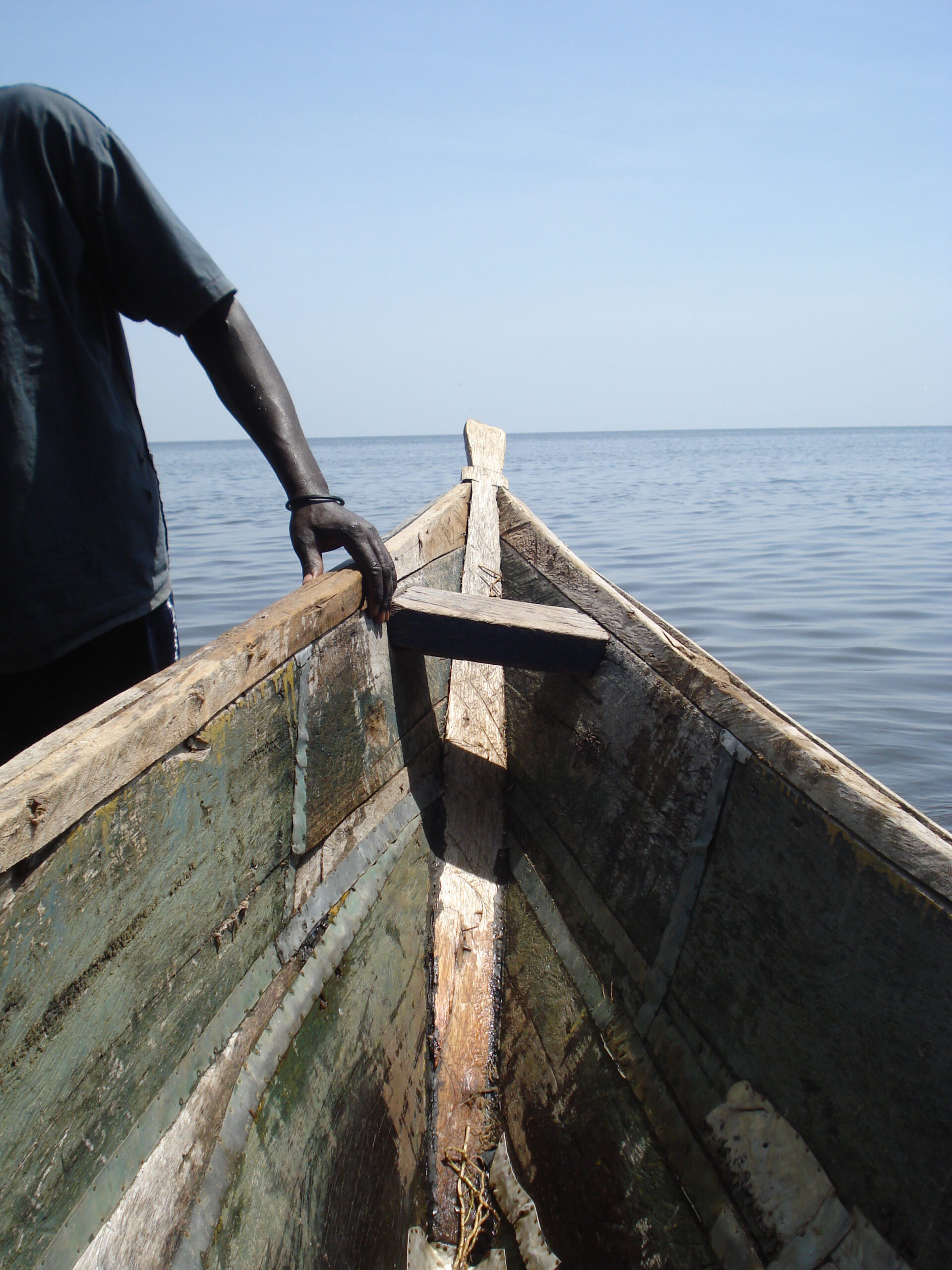
    Most first-time visitors to Kenya never make it past the safari circuit and the coast. Kisumu, the country’s third-largest city, sits on the shores of Lake Victoria – Africa’s largest lake – and offers a completely different Kenya: lakeside, Luo, and largely free of tour buses.

    Lake Victoria shoreline at Kisumu, Kenya
    Guide

    Why Kisumu is worth the detour

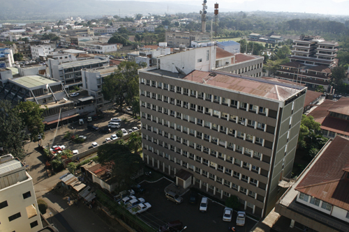
    Kisumu began life as “Port Florence”, the inland terminus of the old Uganda Railway, and that trading-post history still shapes the city’s relaxed, mixed-culture waterfront feel. It sits about 340km west of Nairobi on the Winam Gulf, and it introduces travellers to a completely different ecosystem from the savannah – the operational heart of one of Africa’s most important freshwater fisheries.

    Aerial view of Kisumu city on the shore of Lake Victoria, Kenya
    Photo: DEMOSH, CC BY 2.0, via Wikimedia Commons
    Heritage

    A short history

    The railway reached the lakeshore in 1901, and the settlement that grew up around the terminus was renamed Kisumu a few years later – a Luo word connected to trade and barter, reflecting the town’s early role as a lake port moving goods between the coast, Uganda and the interior. Kisumu was Kenya’s main port for decades, and though rail and lake traffic have declined since independence, the city has kept its role as the commercial and cultural capital of Luo Nyanza, with a slower, more lakeside rhythm than Nairobi or Mombasa.

    Getting there

    Getting around once you're there

    Kisumu is compact enough to explore on foot in the centre, but boda bodas (motorbike taxis) and tuk-tuks are the fastest way to cover longer distances, and metered taxis or ride-hailing apps are widely available for a more comfortable option. Oginga Odinga Street is the main commercial spine downtown, lined with shops, banks and street-side vendors – a good orientation point before heading out toward the lake.

    Oginga Odinga Street in central Kisumu, Kenya
    Things to do

    Things to do

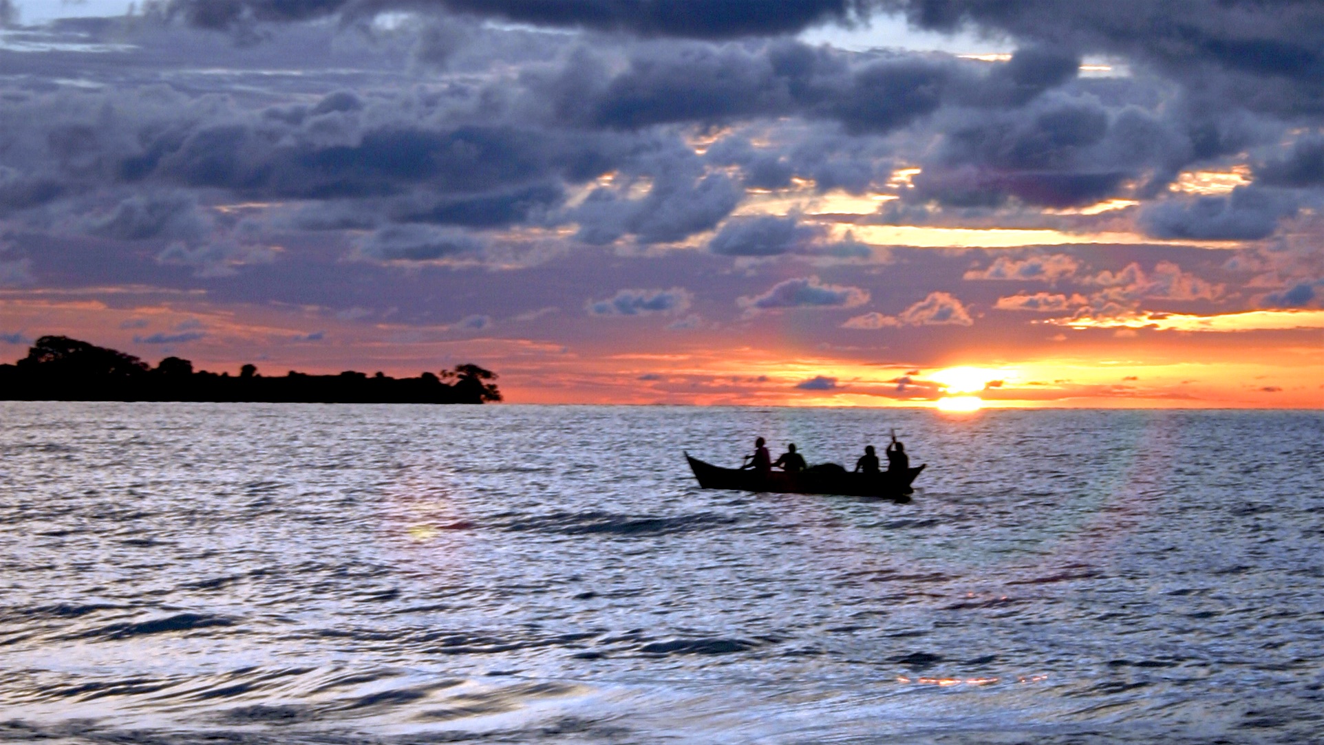
    Dunga Beach. A working fishing village on the lakeshore where wooden boats bring in the day’s tilapia catch each afternoon – stick around for a boardwalk stroll through the papyrus wetlands and a plate of freshly grilled fish. Dunga Hill Camp, just along the shore, is a relaxed spot for a sundowner with lake views.

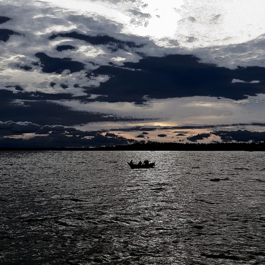
    Fishermen rowing out onto Lake Victoria at dusk near Kisumu
    Photo: Khanairobi, CC BY-SA 4.0, via Wikimedia Commons

    Kisumu Impala Sanctuary. A short walk from the city centre, with impala, zebra and hippo roaming lakeside trails, plus a small animal orphanage and a boat-launch point onto the lake – an easy half-day if a full safari isn’t on the itinerary.

    Hippo Point. A viewpoint a short drive from town, best visited early morning or at sunset, where resident hippos are regularly spotted offshore along with fish eagles and kingfishers working the shallows.

    Ndere Island National Park. A roughly 30-minute boat ride onto Lake Victoria itself, with acacia woodland, sitatunga antelope, monitor lizards and prime birdwatching – genuinely quiet, since almost no one makes the crossing.

    Kisumu Museum. One of the country’s better regional museums, with Luo homestead replicas, a snake park and exhibits on Lake Victoria’s ecosystem and fishing traditions.

    Kibuye Market. One of East Africa’s largest open-air markets, sprawling out from the city centre and busiest on Wednesdays and Sundays – textiles, produce, secondhand clothing and a genuine slice of everyday Kisumu life rather than a tourist-facing craft stall.

    Lwang’ni Beach. A row of open-air lakeside eateries near the yacht club serving grilled and fried tilapia straight from the lake – the default answer to “where should I eat in Kisumu” for most locals.

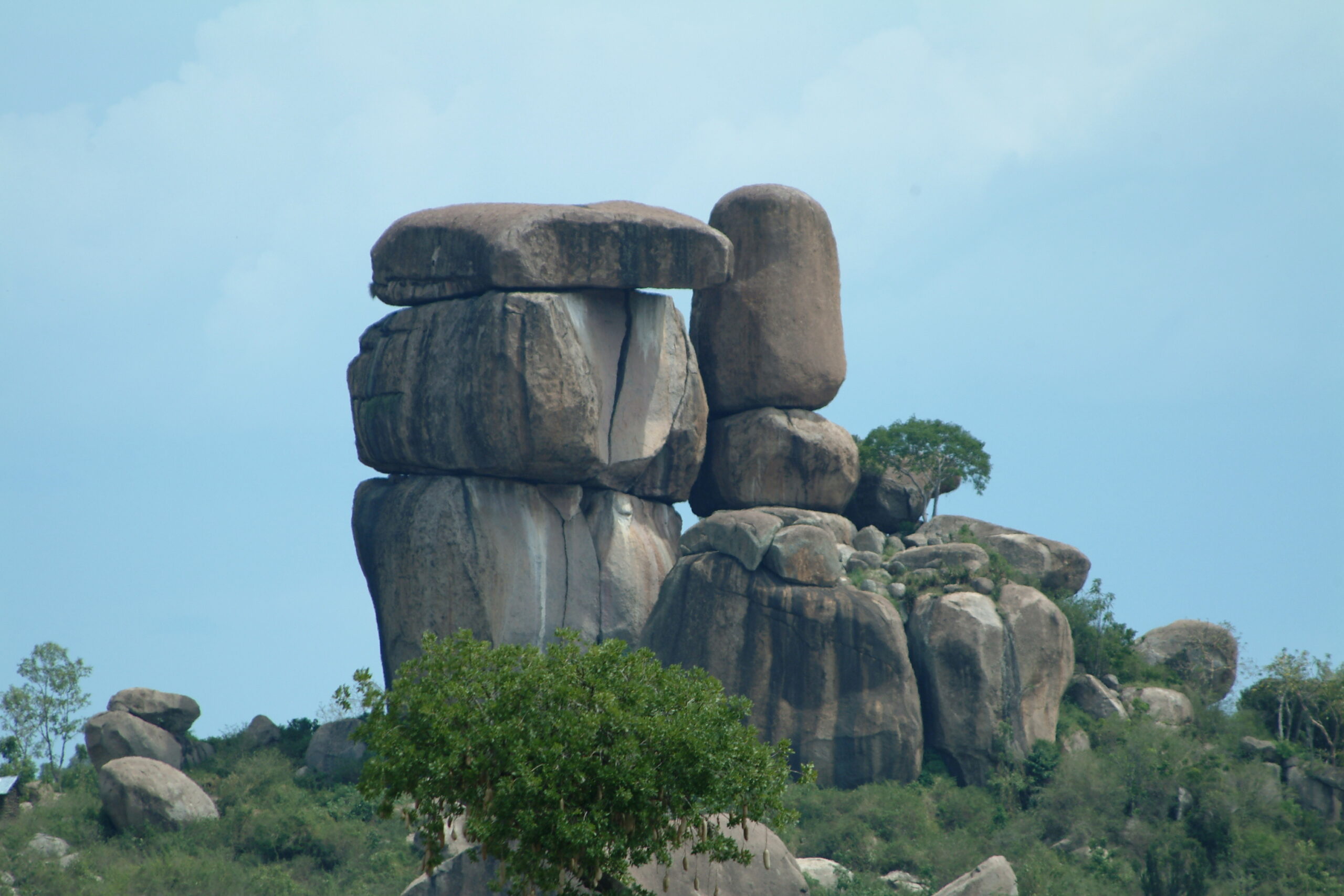
    Kit Mikayi. A striking rock formation about 30km west of the city, its columns rising some 120 metres and arranged, Luo tradition holds, like a polygamous homestead – the largest central rock is Mikayi, the first wife, flanked by the stones of the second and third wives. The name means “stone of the first wife,” and the best-known legend tells of an old man, Ngeso, so devoted to the rock that he spent his days in its caves, prompting his wife to explain his absence by saying he had “gone to his first wife.” It is still a site of worship and pilgrimage for the local Luo-Kakello clan, with caves to climb into and panoramic views over Kisumu and the lake from the top.

    Kit Mikayi rock formation near Kisumu, Kenya
    Photo: Valerius Tygart, CC BY-SA 3.0, via Wikimedia Commons
    Guide

    What to eat

    Kisumu’s food scene runs on the lake: whole fried or grilled tilapia, ugali, and omena (small dried or fresh silver fish) are the local staples, best eaten at Lwang’ni Beach or Dunga Beach rather than a hotel restaurant. Kisumu is also known for a livelier nightlife than its laid-back daytime pace suggests, with lakeside bars around the yacht club filling up on weekend evenings.

    Where to stay

    Where to stay

    Central options along or near Oginga Odinga Street put you walking distance from restaurants and the market; lakeside hotels toward Milimani or the Impala Sanctuary side trade a bit of convenience for quieter, greener surroundings and better lake views.

    Itinerary

    A simple 2-3 day plan

    Day 1. Orient yourself downtown, visit Kisumu Museum, then head to Lwang’ni Beach for a fish dinner at sunset.

    Day 2. Morning at the Impala Sanctuary and Hippo Point, afternoon boat trip to Ndere Island if the weather’s cooperating.

    Day 3. Half-day trip out to Kit Mikayi, or extend north to Siaya for Kogelo and the Yala Swamp before flying out.

    When to go

    Best time to visit

    Kisumu sits on the equator and stays warm and humid year-round. The driest, most comfortable stretches for lakeside walks and boat trips are typically June to September and January to February – similar timing to the classic safari season further east.

    Getting there

    Getting there

    Kisumu has its own airport with regular domestic flights from Nairobi (roughly an hour), or it’s a scenic road trip through the Rift Valley if you’re combining it with a wider Kenya itinerary.

    Good to know

    Frequently asked questions

    Yes – like any Kenyan city, use normal precautions (keep valuables secure in markets, use registered taxis at night), but Kisumu has a notably relaxed pace compared with Nairobi.
    Yes, though it’s a different region of the country – most visitors treat it as a separate 2-3 day add-on rather than a stop en route to the Mara.
    Two to three days covers the city and a couple of half-day trips comfortably; add a day if you want to include Siaya or a longer Ndere Island excursion.
    Bilharzia (schistosomiasis) is present in parts of the lake, so most visitors stick to boat trips and shoreline walks rather than swimming – ask locally about any designated safe swimming spots.

    Ready to plan your trip?

    Compare flights and hotels in one search.

  • How to Plan a US, Canada and Mexico Road Trip

    How to Plan a US, Canada and Mexico Road Trip

    Combining the US, Canada and Mexico in one road trip is genuinely possible, but crossing international borders by car takes more planning than a domestic route.

    Documentation you’ll need

    Beyond your passport and any required visa or entry authorization (like an ESTA for the US or an eTA for Canada), a cross-border road trip usually needs proof of car insurance valid in each country and, for a rental car, written permission from the rental company to cross the border — confirm this before you book.

    Rental car cross-border rules

    Not all rental companies allow their cars to cross into another country, and those that do often restrict which border crossings are permitted. Check the rental terms specifically for cross-border travel rather than assuming it’s included.

    Realistic distances

    North America is vast — a route touching all three countries in one trip usually means choosing one region to focus on (for example, the Pacific coast from Vancouver to San Diego, or the US–Mexico border region) rather than trying to cover the whole continent.

    Border crossing practicalities

    Wait times at land borders vary a lot by crossing and time of day — build buffer time into your schedule, especially for the busiest US–Mexico crossings, and have all documentation for every passenger ready before you reach the checkpoint.

    Planning your trip

    Check car rental options that explicitly allow cross-border travel, compare flights if you’d rather fly one leg, and see our North America travel guide for entry requirements by country.

    FAQ

    Can any rental car cross into Mexico or Canada? No — many rental agreements prohibit it entirely. Always confirm cross-border permission with the rental company in writing before you travel.

    Do I need a visa for all three countries? Requirements depend on your nationality — many travelers qualify for the US Visa Waiver Program (ESTA) and a Canadian eTA, while Mexico allows visa-free entry for many nationalities. Check each country’s immigration authority before booking.

    Related

  • Best Time to Visit North America’s National Parks

    Best Time to Visit North America's National Parks

    North America’s national parks each have their own peak season, shoulder season and off-season trade-offs — timing your visit right avoids both bad weather and overwhelming crowds.

    Summer (June – August): peak season

    Warmest weather and full access to high-altitude trails and roads that stay snowed-in earlier in the year, but also the busiest months at parks like Yellowstone, Banff and the Grand Canyon — expect crowded parking lots and booked-out lodges.

    Shoulder seasons (April – May, September – October)

    Generally the best balance — thinner crowds, lower accommodation rates, and comfortable daytime temperatures at lower elevations. Some high-altitude roads and trails may still be closed or newly reopened, so check individual park conditions before you go.

    Winter (November – March)

    Many parks shift toward winter activities — skiing and snowshoeing in the Rockies, for example — while some high-elevation roads close entirely. Desert parks like the Grand Canyon’s South Rim stay open and are notably less crowded than in summer.

    Booking around peak season

    Popular parks often require lodging and even entry reservations booked months ahead for summer visits. If your dates are flexible, shoulder season significantly improves your odds of last-minute availability.

    Planning your trip

    Once you’ve picked your season, compare flights to your gateway city, check car rental options for the drive between parks, and see our North America travel guide for more planning tips.

    FAQ

    Do I need to book park entry in advance? Several popular US national parks now require timed-entry reservations during peak season — check the specific park’s official site before you travel.

    Is shoulder season risky for closures? Some higher-elevation roads and trails may still be closed in spring or newly closed in autumn — check current conditions for your specific park before finalizing plans.

    Related

  • Best Time to Visit Asia by Region

    Best Time to Visit Asia by Region

    Asia is too large and climatically varied for one blanket answer to “when should I go” — the right time depends heavily on which part of the continent you’re visiting.

    Southeast Asia: November – March

    This window avoids monsoon season across most of Thailand, Vietnam, Cambodia and Indonesia, with dry, sunny conditions. April and May run hot and humid before the rains return around June.

    Japan and South Korea: spring and autumn

    Late March to May brings cherry blossom season and comfortable temperatures; September to November offers autumn foliage with similarly mild weather. Summer is hot and humid, and winter is cold but good for skiing in northern regions.

    China: spring and autumn

    April–May and September–October avoid both summer heat and winter cold across most of the country, though China’s size means climate varies significantly between the north and south.

    Combining regions in one trip

    If your itinerary spans, say, Japan and Southeast Asia, look for the overlap — spring and autumn tend to work reasonably well for both, whereas peak summer is uncomfortable in the tropics and peak winter is cold in East Asia.

    Planning your trip

    Once you’ve picked your season, compare flights into your first destination, check our Asia travel guide for attraction and hotel ideas, and see our guide to planning a multi-country Southeast Asia trip if you’re combining stops.

    FAQ

    Is there ever a bad time to visit all of Asia at once? Not exactly, but each sub-region has its own weather pattern, so check the specific countries on your itinerary rather than treating “Asia” as one climate.

    When should I avoid Southeast Asia? Monsoon season (roughly June–October in much of the region) brings heavy rain and higher humidity, though it varies by country and isn’t a reason to rule out travel entirely.

    Related

  • How to Plan a Multi-Country Southeast Asia Trip

    How to Plan a Multi-Country Southeast Asia Trip

    Southeast Asia is one of the easiest regions in the world to combine several countries in one trip — but the logistics work differently than a Europe-style rail hop.

    Choosing your route

    Overland travel is common and cheap between neighboring countries (Thailand, Laos, Cambodia and Vietnam connect well by bus and train), but crossing by land takes time. For a shorter trip, budget regional flights between hub cities are often faster and not much more expensive.

    How many countries is too many?

    For a two- to three-week trip, two or three countries is realistic without feeling rushed. Border crossings, visa processing and travel days all eat into your time — build in buffer days rather than packing the itinerary end to end.

    Visas across multiple countries

    Requirements vary a lot by nationality and by country — some offer visa-free entry or visa-on-arrival, others require an e-visa arranged in advance. If your route crosses several countries, check each one individually well before you travel, since processing times differ.

    Money and connectivity

    Each country uses its own currency, so budget for ATM withdrawals in each stop rather than trying to carry one currency across borders. Setting up an eSIM before you fly is the simplest way to stay connected as you cross into each new country.

    Planning your trip

    Once you’ve mapped your route, compare flights into your first stop, check our Asia travel guide for what to see in each country, and make sure you’re covered with travel insurance for the whole trip.

    FAQ

    Is it cheaper to cross borders by land or fly? Land travel is usually cheaper but slower; regional budget flights can cost only a little more and save a full day of travel on longer hops.

    Do I need a different SIM in each country? Not necessarily — some eSIM plans cover multiple Southeast Asian countries on one plan, which is worth checking before you buy separate local SIMs.

    Related

  • Planning a Multi-Country Europe Trip by Rail

    Planning a Multi-Country Europe Trip by Rail

    Europe’s rail network makes multi-country trips genuinely easy — but a good rail itinerary takes a bit more planning than booking flights city to city.

    Rail pass vs point-to-point tickets

    A multi-country rail pass can be worthwhile if you’re covering a lot of ground with several long journeys, since it bundles travel into one purchase. For a shorter trip with just two or three stops, individual point-to-point tickets booked in advance are often cheaper — compare both before committing.

    Don’t overpack your itinerary

    The biggest planning mistake is trying to see too many cities. Factor in that a train journey between major hubs can easily take half a day, and build in at least two nights per stop so travel time doesn’t eat your whole trip.

    Overnight trains vs flying

    Overnight trains save a hotel night and put you in the next city by morning, which works well for longer hops. For very long distances, a short regional flight can still be faster and, at times, similarly priced — compare both options for each leg.

    Booking considerations

    High-speed routes between major cities (like Paris–London or Rome–Milan) sell out on popular dates, so book those legs early. Regional and slower routes are usually fine to book closer to travel. Reserve seats where required — some rail passes still need a separate seat reservation.

    Planning your trip

    Once you’ve mapped your route, compare flights into your starting city, check our Europe travel guide for what to see in each stop, and make sure you’re covered with travel insurance for the whole trip.

    FAQ

    Is a rail pass cheaper than flying between cities? It depends on the route and how far in advance you book flights — budget airlines can undercut rail on some routes, so it’s worth comparing both for your specific itinerary.

    Do I need to book seats in advance? On high-speed and popular routes, yes — seat reservations are often required even with a rail pass, and trains can sell out on peak dates.

    Related

  • Best Time to Visit Europe: A Season-by-Season Guide

    Best Time to Visit Europe: A Season-by-Season Guide

    Europe rewards different travelers at different times of year — the right season depends on whether you want beach weather, empty museums, or Christmas markets.

    June – August: peak summer

    Warm weather across the continent, the Mediterranean coast at its best, and the longest daylight hours for sightseeing. It’s also the most crowded and expensive window, with major cities and coastal towns booked out well in advance.

    April – May and September – October: shoulder season

    Widely considered the sweet spot. Comfortable temperatures, thinner crowds at major sights, and lower hotel rates than peak summer, while still enough daylight and open attractions to sightsee comfortably.

    November – December: Christmas markets

    Germany, Austria and Central Europe come alive with Christmas markets from late November. Cold weather, but a distinct atmosphere — book accommodation early since market season draws steady crowds despite the chill.

    January – March: low season and ski season

    The cheapest window for cities, with fewer tourists and better rates, though shorter days and colder weather in the north. This is also peak season for the Alps, where ski resorts run at capacity through February.

    Planning your trip

    Once you’ve picked your season, compare flights into your first European city, check our Europe travel guide for attraction and hotel ideas, and make sure you’re covered with travel insurance before you go.

    FAQ

    Is summer worth the crowds? If your destinations are coastal or beach-focused, yes — but for city-heavy itineraries, shoulder season usually offers a better balance of weather and crowd levels.

    Do prices really drop in winter? Generally yes for flights and city hotels, though Alpine ski destinations are a notable exception and can be priced at a premium through peak ski season.

    Related